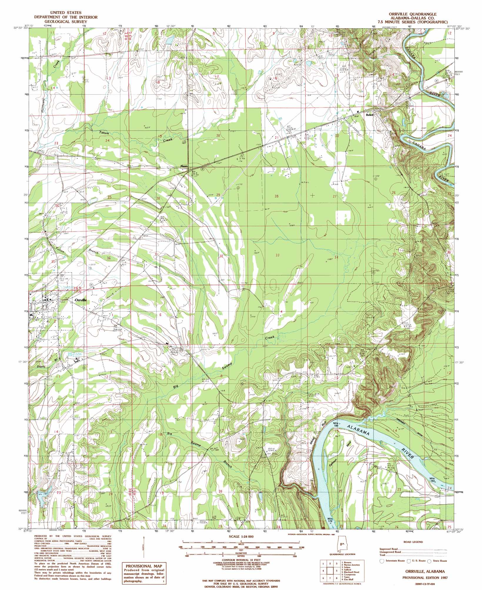
Orrville Topo Map Alabama
To zoom in, hover over the map of Orrville
USGS Topo Quad 32087c2 - 1:24,000 scale
| Topo Map Name: | Orrville |
| USGS Topo Quad ID: | 32087c2 |
| Print Size: | ca. 21 1/4" wide x 27" high |
| Southeast Coordinates: | 32.25° N latitude / 87.125° W longitude |
| Map Center Coordinates: | 32.3125° N latitude / 87.1875° W longitude |
| U.S. State: | AL |
| Filename: | o32087c2.jpg |
| Download Map JPG Image: | Orrville topo map 1:24,000 scale |
| Map Type: | Topographic |
| Topo Series: | 7.5´ |
| Map Scale: | 1:24,000 |
| Source of Map Images: | United States Geological Survey (USGS) |
| Alternate Map Versions: |
Selma SW AL 1975, updated 1977 Download PDF Buy paper map Orrville AL 1987, updated 1987 Download PDF Buy paper map Orrville AL 2011 Download PDF Buy paper map Orrville AL 2014 Download PDF Buy paper map |
1:24,000 Topo Quads surrounding Orrville
Scott Station |
Marion South |
Suttle |
Summerfield |
Jones |
Uniontown East |
Browns |
Marion Junction |
Selma |
Burnsville |
Central Mills |
Safford |
Orrville |
Blackwell Bend |
Sardis |
Catherine |
Crumptonia |
Tasso |
Elm Bluff |
Pleasant Hill |
Lee Long Bridge |
Camden North |
Tilden |
Carlowville |
Minter |
> Back to 32087a1 at 1:100,000 scale
> Back to 32086a1 at 1:250,000 scale
> Back to U.S. Topo Maps home
Orrville topo map: Gazetteer
Orrville: Bars
Lucy Gastrell Bar elevation 24m 78′Mary Taylor Bar elevation 28m 91′
Mitchell Bar elevation 24m 78′
White Bluff Bar elevation 24m 78′
Orrville: Bends
Calhoun Bend elevation 28m 91′Orrville: Canals
Threemile Ditch elevation 29m 95′Orrville: Cliffs
Whites Bluff elevation 73m 239′Orrville: Populated Places
Beloit elevation 60m 196′Hazen elevation 52m 170′
Orrville elevation 58m 190′
Whites Bluff elevation 75m 246′
Orrville: Streams
Big Swamp Branch elevation 48m 157′Childers Creek elevation 26m 85′
Hurricane Creek elevation 43m 141′
Orrville digital topo map on disk
Buy this Orrville topo map showing relief, roads, GPS coordinates and other geographical features, as a high-resolution digital map file on DVD:
Gulf Coast (LA, MS, AL, FL) & Southwestern Georgia
Buy digital topo maps: Gulf Coast (LA, MS, AL, FL) & Southwestern Georgia
 & Southwestern Georgia map DVD")