Eightmile Draw Topo Map New Mexico
To zoom in, hover over the map of Eightmile Draw
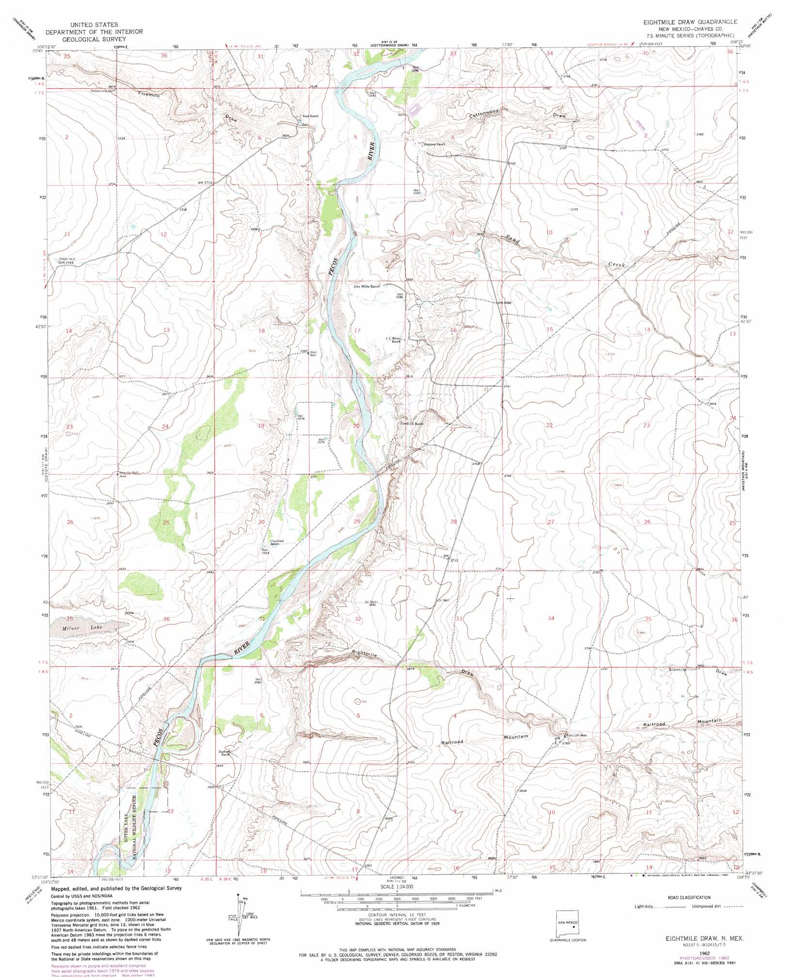
USGS Topo Quad 33104f3 - 1:24,000 scale
| Topo Map Name: | Eightmile Draw |
| USGS Topo Quad ID: | 33104f3 |
| Print Size: | ca. 21 1/4" wide x 27" high |
| Southeast Coordinates: | 33.625° N latitude / 104.25° W longitude |
| Map Center Coordinates: | 33.6875° N latitude / 104.3125° W longitude |
| U.S. State: | NM |
| Filename: | o33104f3.jpg |
| Download Map JPG Image: | Eightmile Draw topo map 1:24,000 scale |
| Map Type: | Topographic |
| Topo Series: | 7.5´ |
| Map Scale: | 1:24,000 |
| Source of Map Images: | United States Geological Survey (USGS) |
| Alternate Map Versions: |
Eightmile Draw NM 1962, updated 1964 Download PDF Buy paper map Eightmile Draw NM 1962, updated 1968 Download PDF Buy paper map Eightmile Draw NM 1962, updated 1982 Download PDF Buy paper map Eightmile Draw NM 2010 Download PDF Buy paper map Eightmile Draw NM 2013 Download PDF Buy paper map Eightmile Draw NM 2017 Download PDF Buy paper map |
1:24,000 Topo Quads surrounding Eightmile Draw
Dunlap Sill |
Swallow Nest Canyon |
Deering Place |
Hernandez Lake |
Olive |
Mesa Se |
Shannon Draw |
Cottonwood Draw |
Haystack Butte |
Denton Camp |
Marley Draw |
Coyote Draw |
Eightmile Draw |
Haystack Mountain |
Elkins |
Panther Hill |
Melena |
Acme |
Campbell |
Sardine Lake |
Roswell North |
Bitter Lake |
Comanche Spring |
L E Ranch |
Sardine Mountain |
> Back to 33104e1 at 1:100,000 scale
> Back to 33104a1 at 1:250,000 scale
> Back to U.S. Topo Maps home
Eightmile Draw topo map: Gazetteer
Eightmile Draw: Lakes
Milner Lake elevation 1090m 3576′Eightmile Draw: Streams
Sand Creek elevation 1091m 3579′Eightmile Draw: Valleys
Cottonwood Draw elevation 1095m 3592′Eightmile Draw elevation 1084m 3556′
Fivemile Draw elevation 1092m 3582′
Sixmile Draw elevation 1166m 3825′
Eightmile Draw digital topo map on disk
Buy this Eightmile Draw topo map showing relief, roads, GPS coordinates and other geographical features, as a high-resolution digital map file on DVD: