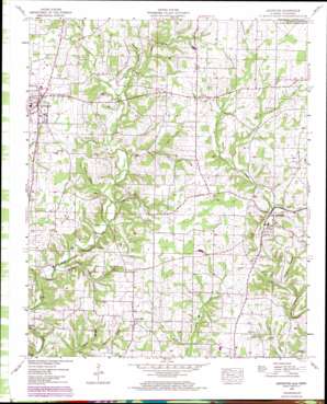
Lexington Topo Map Alabama
To zoom in, hover over the map of Lexington
USGS Topo Quad 34087h3 - 1:24,000 scale
| Topo Map Name: | Lexington |
| USGS Topo Quad ID: | 34087h3 |
| Print Size: | ca. 21 1/4" wide x 27" high |
| Southeast Coordinates: | 34.875° N latitude / 87.25° W longitude |
| Map Center Coordinates: | 34.9375° N latitude / 87.3125° W longitude |
| U.S. States: | AL, TN |
| Filename: | o34087h3.jpg |
| Download Map JPG Image: | Lexington topo map 1:24,000 scale |
| Map Type: | Topographic |
| Topo Series: | 7.5´ |
| Map Scale: | 1:24,000 |
| Source of Map Images: | United States Geological Survey (USGS) |
| Alternate Map Versions: |
Lexington AL 1936 Download PDF Buy paper map Lexington AL 1952, updated 1957 Download PDF Buy paper map Lexington AL 1952, updated 1973 Download PDF Buy paper map Lexington AL 2010 Download PDF Buy paper map Lexington AL 2011 Download PDF Buy paper map Lexington AL 2014 Download PDF Buy paper map |
1:24,000 Topo Quads surrounding Lexington
> Back to 34087e1 at 1:100,000 scale
> Back to 34086a1 at 1:250,000 scale
> Back to U.S. Topo Maps home
Lexington topo map: Gazetteer
Lexington: Bridges
Sledge Ford Bridge elevation 188m 616′Lexington: Cliffs
Ivy Bluff elevation 198m 649′Lexington: Crossings
Ingram Ford elevation 195m 639′Moody Ford elevation 189m 620′
Sledge Ford elevation 188m 616′
Lexington: Populated Places
Anderson elevation 202m 662′Cedar Hill (historical) elevation 210m 688′
Corum (historical) elevation 229m 751′
Grassy elevation 239m 784′
Hurricane (historical) elevation 207m 679′
Lexington elevation 234m 767′
Powell elevation 251m 823′
Whitehead elevation 225m 738′
Lexington: Post Offices
Arthur Post Office (historical) elevation 244m 800′Lexington: Springs
Carter Spring elevation 217m 711′Hurn Spring elevation 232m 761′
Lexington: Streams
Beaverdam Branch elevation 189m 620′Bills Branch elevation 193m 633′
Birch Branch elevation 242m 793′
Birch Branch elevation 242m 793′
Corn Branch elevation 221m 725′
Cotts Creek elevation 202m 662′
Cotts Creek elevation 202m 662′
Crossroads Branch elevation 213m 698′
Crossroads Branch elevation 213m 698′
Dry Branch elevation 206m 675′
Dry Branch elevation 206m 675′
East Fork Anderson Creek elevation 201m 659′
Hammond Branch elevation 207m 679′
Herston Branch elevation 187m 613′
Hurn Spring Branch elevation 223m 731′
Hurricane Branch elevation 202m 662′
Marshall Branch elevation 197m 646′
Middle Fork Anderson Creek elevation 212m 695′
Monk Branch elevation 194m 636′
Pole Bridge Branch elevation 241m 790′
Pole Bridge Branch elevation 241m 790′
Springfield Branch elevation 176m 577′
West Fork Anderson Creek elevation 212m 695′
White Branch elevation 213m 698′
Lexington: Valleys
Corum Hollow elevation 188m 616′Sawmill Hollow elevation 206m 675′
Stout Hollow elevation 196m 643′
Strickland Hollow elevation 195m 639′
Lexington digital topo map on disk
Buy this Lexington topo map showing relief, roads, GPS coordinates and other geographical features, as a high-resolution digital map file on DVD:


