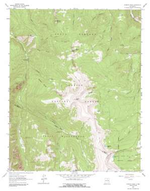
Jicarita Peak Topo Map New Mexico
To zoom in, hover over the map of Jicarita Peak
USGS Topo Quad 36105a5 - 1:24,000 scale
| Topo Map Name: | Jicarita Peak |
| USGS Topo Quad ID: | 36105a5 |
| Print Size: | ca. 21 1/4" wide x 27" high |
| Southeast Coordinates: | 36° N latitude / 105.5° W longitude |
| Map Center Coordinates: | 36.0625° N latitude / 105.5625° W longitude |
| U.S. State: | NM |
| Filename: | o36105a5.jpg |
| Download Map JPG Image: | Jicarita Peak topo map 1:24,000 scale |
| Map Type: | Topographic |
| Topo Series: | 7.5´ |
| Map Scale: | 1:24,000 |
| Source of Map Images: | United States Geological Survey (USGS) |
| Alternate Map Versions: |
Jicarita Peak NM 1964, updated 1967 Download PDF Buy paper map Jicarita Peak NM 1964, updated 1972 Download PDF Buy paper map Jicarita Peak NM 1964, updated 1987 Download PDF Buy paper map Jicarita Peak NM 1995, updated 1997 Download PDF Buy paper map Jicarita Peak NM 2011 Download PDF Buy paper map Jicarita Peak NM 2013 Download PDF Buy paper map Jicarita Peak NM 2017 Download PDF Buy paper map |
| FStopo: | US Forest Service topo Jicarita Peak is available: Download FStopo PDF Download FStopo TIF |
1:24,000 Topo Quads surrounding Jicarita Peak
> Back to 36105a1 at 1:100,000 scale
> Back to 36104a1 at 1:250,000 scale
> Back to U.S. Topo Maps home
Jicarita Peak topo map: Gazetteer
Jicarita Peak: Lakes
Horseshoe Lake elevation 3583m 11755′Indian Lake elevation 2899m 9511′
North Fork Lake elevation 3605m 11827′
Serpent Lake elevation 3580m 11745′
Jicarita Peak: Streams
East Fork Rio Santa Barbara elevation 3107m 10193′Jicarita Creek elevation 2718m 8917′
Middle Fork Rio Santa Barbara elevation 2829m 9281′
West Fork Rio Santa Barbara elevation 2829m 9281′
Jicarita Peak: Summits
Bear Mountain elevation 3122m 10242′Jicarita Peak elevation 3904m 12808′
Little Jicarita Peak elevation 3757m 12326′
Peñascoso Mountain elevation 3332m 10931′
Ripley Point elevation 3594m 11791′
The Knob elevation 3238m 10623′
Jicarita Peak: Swamps
Los Esteros elevation 3398m 11148′Jicarita Peak: Trails
Comales Trail elevation 3374m 11069′Divide Trail elevation 3793m 12444′
Osha Trail elevation 3221m 10567′
Santa Barbara Angostura Trail elevation 3408m 11181′
West Fork Angostura Trail elevation 2936m 9632′
Jicarita Peak: Valleys
Indian Canyon elevation 2703m 8868′Jicarita Peak digital topo map on disk
Buy this Jicarita Peak topo map showing relief, roads, GPS coordinates and other geographical features, as a high-resolution digital map file on DVD:


