La Madre Mountain Topo Map Nevada
To zoom in, hover over the map of La Madre Mountain
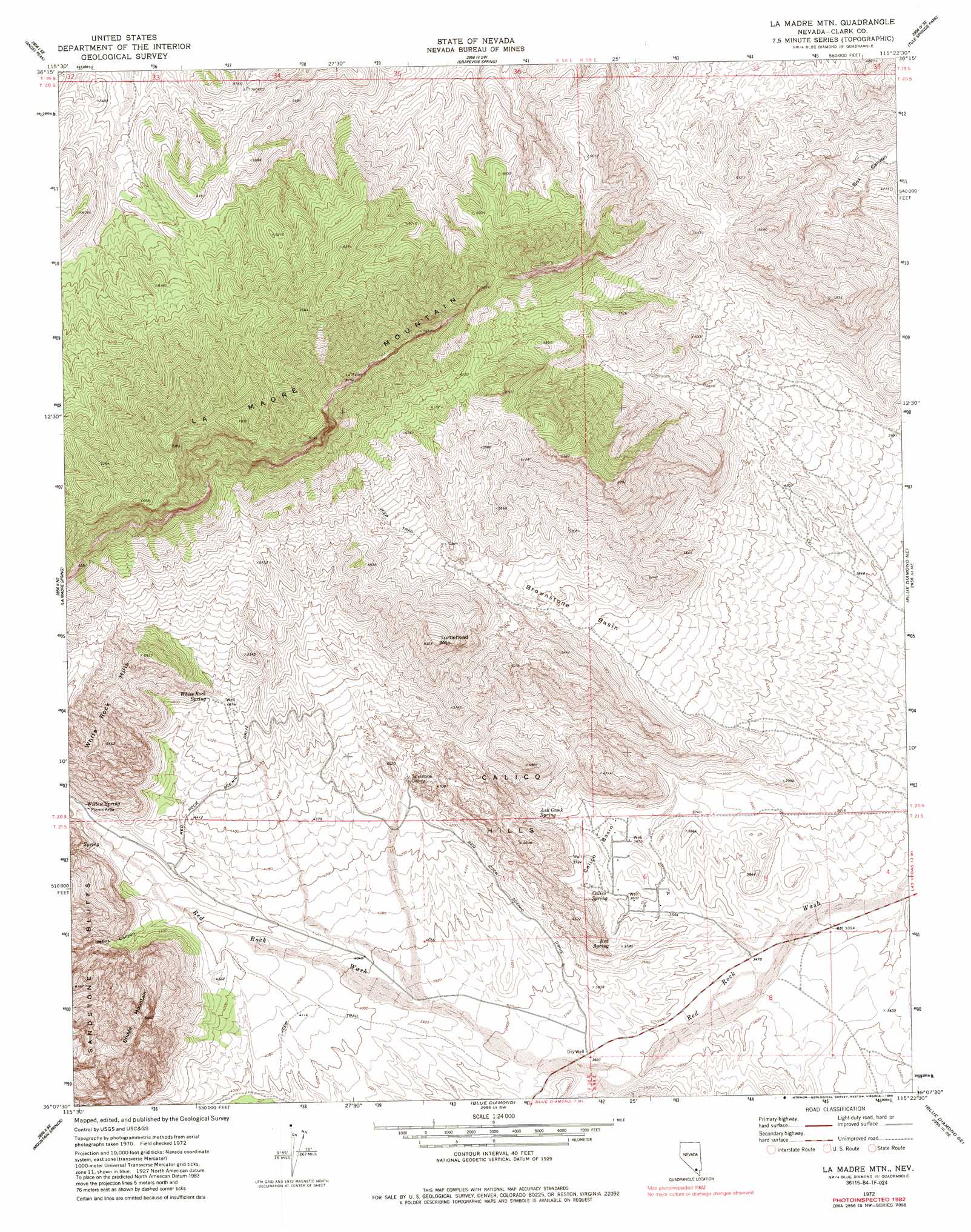
USGS Topo Quad 36115b4 - 1:24,000 scale
| Topo Map Name: | La Madre Mountain |
| USGS Topo Quad ID: | 36115b4 |
| Print Size: | ca. 21 1/4" wide x 27" high |
| Southeast Coordinates: | 36.125° N latitude / 115.375° W longitude |
| Map Center Coordinates: | 36.1875° N latitude / 115.4375° W longitude |
| U.S. State: | NV |
| Filename: | o36115b4.jpg |
| Download Map JPG Image: | La Madre Mountain topo map 1:24,000 scale |
| Map Type: | Topographic |
| Topo Series: | 7.5´ |
| Map Scale: | 1:24,000 |
| Source of Map Images: | United States Geological Survey (USGS) |
| Alternate Map Versions: |
La Madre Mtn NV 1972, updated 1974 Download PDF Buy paper map La Madre Mtn NV 1972, updated 1986 Download PDF Buy paper map La Madre Mtn NV 1972, updated 1986 Download PDF Buy paper map La Madre Mtn NV 1972, updated 1986 Download PDF Buy paper map La Madre Mountain NV 2012 Download PDF Buy paper map La Madre Mountain NV 2015 Download PDF Buy paper map |
1:24,000 Topo Quads surrounding La Madre Mountain
Cold Creek |
Charleston Peak Ne |
Corn Creek Springs Nw |
Corn Creek Springs |
Gass Peak |
Charleston Peak |
Angel Peak |
Grapevine Spring |
Tule Springs Park |
Gass Peak Sw |
Griffith Peak |
La Madre Spring |
La Madre Mountain |
Blue Diamond Ne |
Las Vegas Nw |
Lost Cabin Spring |
Mountain Springs |
Blue Diamond |
Blue Diamond Se |
Las Vegas Sw |
Green Monster Mine |
Potosi |
Cottonwood Pass |
Bird Spring |
Sloan |
> Back to 36115a1 at 1:100,000 scale
> Back to 36114a1 at 1:250,000 scale
> Back to U.S. Topo Maps home
La Madre Mountain topo map: Gazetteer
La Madre Mountain: Basins
Brownstone Basin elevation 1425m 4675′Calico Basin elevation 1124m 3687′
La Madre Mountain: Flats
Lost Lake elevation 1196m 3923′La Madre Mountain: Springs
Ash Creek Spring elevation 1175m 3854′Calico Spring elevation 1124m 3687′
Red Spring elevation 1118m 3667′
White Rock Spring elevation 1467m 4812′
Willow Spring elevation 1404m 4606′
La Madre Mountain: Summits
Bridge Mountain elevation 1968m 6456′Calico Hills elevation 1505m 4937′
La Madre Mountain elevation 2467m 8093′
Turtlehead Mountain elevation 1856m 6089′
White Rock Hills elevation 1967m 6453′
La Madre Mountain: Valleys
Icebox Canyon elevation 1341m 4399′La Madre Mountain digital topo map on disk
Buy this La Madre Mountain topo map showing relief, roads, GPS coordinates and other geographical features, as a high-resolution digital map file on DVD:
Southern Sierra Nevada, California & Southern Nevada
Buy digital topo maps: Southern Sierra Nevada, California & Southern Nevada