Herrick Topo Map Illinois
To zoom in, hover over the map of Herrick
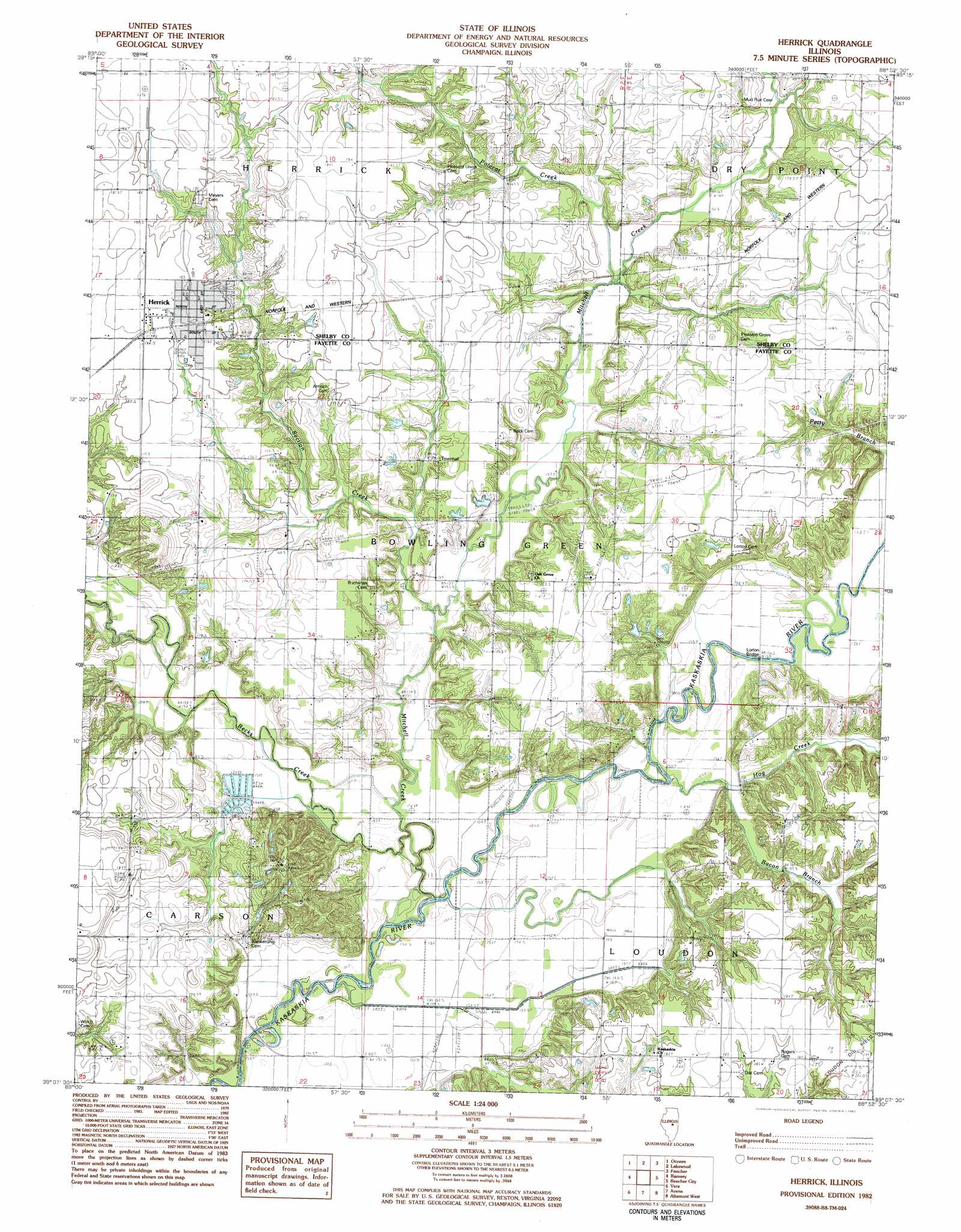
USGS Topo Quad 39088b8 - 1:24,000 scale
| Topo Map Name: | Herrick |
| USGS Topo Quad ID: | 39088b8 |
| Print Size: | ca. 21 1/4" wide x 27" high |
| Southeast Coordinates: | 39.125° N latitude / 88.875° W longitude |
| Map Center Coordinates: | 39.1875° N latitude / 88.9375° W longitude |
| U.S. State: | IL |
| Filename: | o39088b8.jpg |
| Download Map JPG Image: | Herrick topo map 1:24,000 scale |
| Map Type: | Topographic |
| Topo Series: | 7.5´ |
| Map Scale: | 1:24,000 |
| Source of Map Images: | United States Geological Survey (USGS) |
| Alternate Map Versions: |
Herrick IL 1982, updated 1982 Download PDF Buy paper map Herrick IL 1998, updated 2003 Download PDF Buy paper map Herrick IL 2012 Download PDF Buy paper map Herrick IL 2015 Download PDF Buy paper map |
1:24,000 Topo Quads surrounding Herrick
Owaneco |
Pana |
Tower Hill |
Shelbyville |
Middlesworth |
Ohlman |
Oconee |
Lakewood |
Fancher |
Stewardson West |
Ramsey Lake |
Ramsey |
Herrick |
Beecher City |
Shumway |
Bingham |
Vera |
Avena |
Altamont West |
Altamont East |
Hagarstown |
Vandalia |
Brownstown |
Loogootee |
Edgewood |
> Back to 39088a1 at 1:100,000 scale
> Back to 39088a1 at 1:250,000 scale
> Back to U.S. Topo Maps home
Herrick topo map: Gazetteer
Herrick: Bridges
Lorton Bridge elevation 153m 501′Wren Bridge elevation 151m 495′
Herrick: Parks
Dean Hills Nature Preserve elevation 196m 643′Herrick: Populated Places
Herrick elevation 183m 600′Herrick: Streams
Bacon Branch elevation 156m 511′Becks Creek elevation 152m 498′
Hog Creek elevation 152m 498′
Mitchell Creek elevation 152m 498′
Pint Creek elevation 159m 521′
Polecat Creek elevation 161m 528′
Section Creek elevation 155m 508′
Herrick: Summits
Dean Hills elevation 196m 643′Herrick digital topo map on disk
Buy this Herrick topo map showing relief, roads, GPS coordinates and other geographical features, as a high-resolution digital map file on DVD:
Northern Illinois, Northern Indiana & Southwestern Michigan
Buy digital topo maps: Northern Illinois, Northern Indiana & Southwestern Michigan