Maple Creek Topo Map California
To zoom in, hover over the map of Maple Creek
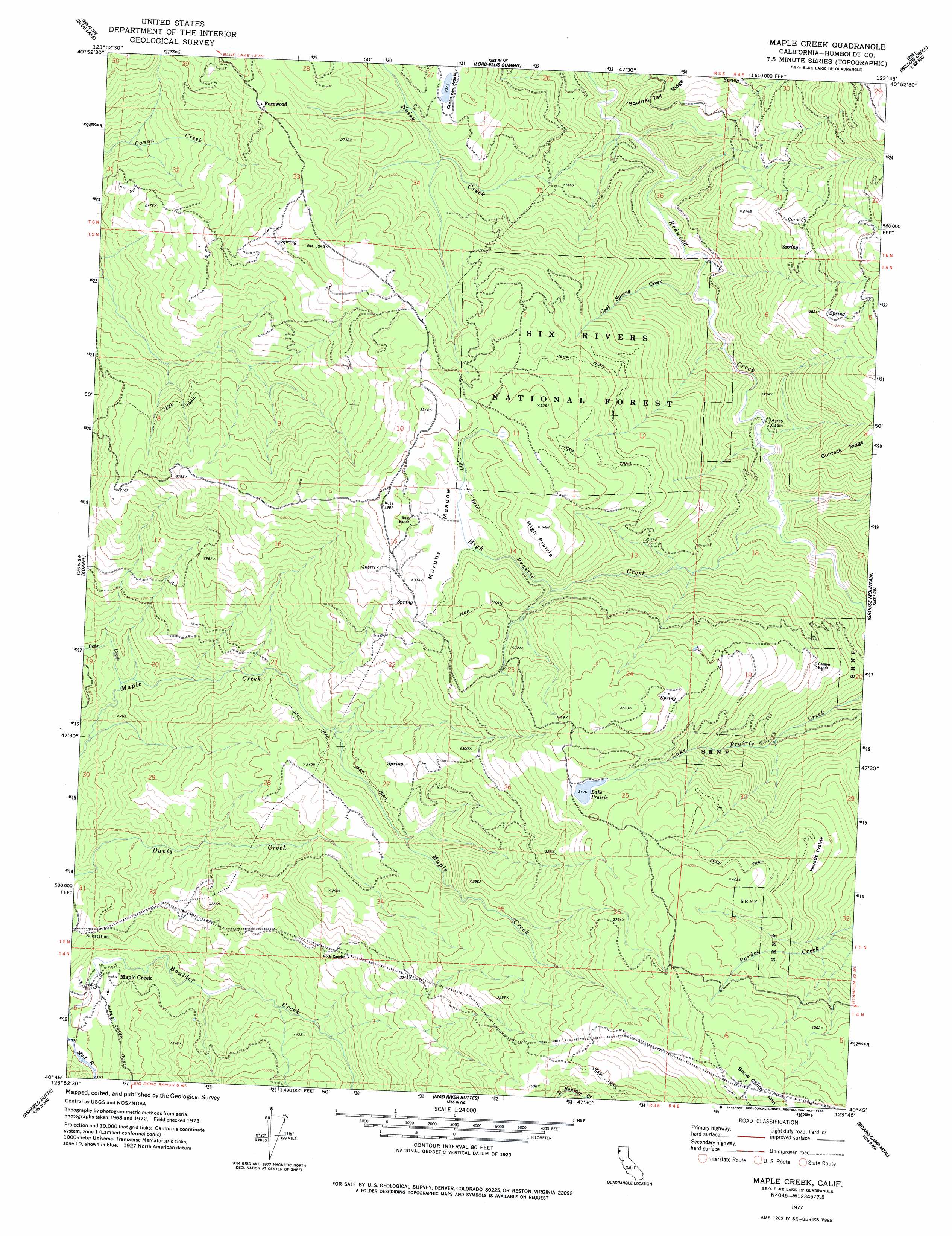
USGS Topo Quad 40123g7 - 1:24,000 scale
| Topo Map Name: | Maple Creek |
| USGS Topo Quad ID: | 40123g7 |
| Print Size: | ca. 21 1/4" wide x 27" high |
| Southeast Coordinates: | 40.75° N latitude / 123.75° W longitude |
| Map Center Coordinates: | 40.8125° N latitude / 123.8125° W longitude |
| U.S. State: | CA |
| Filename: | o40123g7.jpg |
| Download Map JPG Image: | Maple Creek topo map 1:24,000 scale |
| Map Type: | Topographic |
| Topo Series: | 7.5´ |
| Map Scale: | 1:24,000 |
| Source of Map Images: | United States Geological Survey (USGS) |
| Alternate Map Versions: |
Maple Creek CA 1977, updated 1978 Download PDF Buy paper map Maple Creek CA 1997, updated 2001 Download PDF Buy paper map Maple Creek CA 2012 Download PDF Buy paper map Maple Creek CA 2015 Download PDF Buy paper map |
| FStopo: | US Forest Service topo Maple Creek is available: Download FStopo PDF Download FStopo TIF |
1:24,000 Topo Quads surrounding Maple Creek
Crannell |
Panther Creek |
Hupa Mountain |
Hoopa |
Tish Tang Point |
Arcata North |
Blue Lake |
Lord-Ellis Summit |
Willow Creek |
Salyer |
Arcata South |
Korbel |
Maple Creek |
Grouse Mountain |
Hennessy Peak |
Mcwhinney Creek |
Iaqua Buttes |
Mad River Buttes |
Board Camp Mountain |
Sims Mountain |
Hydesville |
Owl Creek |
Yager Junction |
Showers Mountain |
Blake Mountain |
> Back to 40123e1 at 1:100,000 scale
> Back to 40122a1 at 1:250,000 scale
> Back to U.S. Topo Maps home
Maple Creek topo map: Gazetteer
Maple Creek: Areas
Christmas Prairie elevation 726m 2381′Heustis Prairie elevation 1003m 3290′
High Prairie elevation 1061m 3480′
Maple Creek: Flats
Murphy Meadow elevation 920m 3018′Maple Creek: Lakes
Lake Prairie elevation 1061m 3480′Maple Creek: Populated Places
Fernwood elevation 827m 2713′Maple Creek elevation 161m 528′
Maple Creek: Ridges
Gunrack Ridge elevation 806m 2644′Maple Creek: Streams
Bear Creek elevation 178m 583′Cool Spring Creek elevation 343m 1125′
High Prairie Creek elevation 396m 1299′
Noisy Creek elevation 315m 1033′
Maple Creek: Summits
Snow Camp Mountain elevation 1403m 4603′Maple Creek digital topo map on disk
Buy this Maple Creek topo map showing relief, roads, GPS coordinates and other geographical features, as a high-resolution digital map file on DVD: