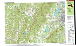
Pittsfield West Topo Map Massachusetts
To zoom in, hover over the map of Pittsfield West
USGS Topo Quad 42073d3 - 1:25,000 scale
| Topo Map Name: | Pittsfield West |
| USGS Topo Quad ID: | 42073d3 |
| Print Size: | ca. 39" wide x 24" high |
| Southeast Coordinates: | 42.375° N latitude / 73.25° W longitude |
| Map Center Coordinates: | 42.4375° N latitude / 73.375° W longitude |
| U.S. States: | MA, NY |
| Filename: | k42073d3.jpg |
| Download Map JPG Image: | Pittsfield West topo map 1:25,000 scale |
| Map Type: | Topographic |
| Topo Series: | 7.5´x15´ |
| Map Scale: | 1:25,000 |
| Source of Map Images: | United States Geological Survey (USGS) |
| Alternate Map Versions: |
Pittsfield West MA 1988, updated 1988 Download PDF Buy paper map Pittsfield West MA 1988, updated 1988 Download PDF Buy paper map Pittsfield West MA 1998, updated 2000 Download PDF Buy paper map |
1:24,000 Topo Quads surrounding Pittsfield West
Averill Park |
Berlin |
North Adams |
||
Nassau |
Hancock |
Windsor |
||
East Chatham |
Pittsfield West |
Peru |
||
Chatham |
Stockbridge |
Becket |
||
Hillsdale |
Great Barrington |
Otis |
> Back to 42073a1 at 1:100,000 scale
> Back to 42072a1 at 1:250,000 scale
> Back to U.S. Topo Maps home
Pittsfield West topo map: Gazetteer
Pittsfield West: Airports
Pittsfield Municipal Airport elevation 356m 1167′Pittsfield West: Capes
Thomas Island elevation 332m 1089′Pittsfield West: Cliffs
Clover Mountain elevation 446m 1463′Pittsfield West: Dams
Lower Pecks Pond Dam elevation 325m 1066′Onota Lake Dam elevation 325m 1066′
Pittsfield West: Falls
Lulu Cascade elevation 398m 1305′Pittsfield West: Forests
Pittsfield State Forest elevation 590m 1935′Pittsfield West: Lakes
Beaver Pond elevation 339m 1112′Beaver Pond elevation 338m 1108′
Beebe Pond elevation 312m 1023′
Cranberry Pond elevation 552m 1811′
Morewood Lake elevation 289m 948′
Mud Pond elevation 350m 1148′
Pecks Pond elevation 316m 1036′
Queechy Lake elevation 311m 1020′
Twin Pond elevation 526m 1725′
Pittsfield West: Parks
Bates Memorial State Park elevation 484m 1587′Burbank Park elevation 346m 1135′
Clapp Park elevation 309m 1013′
Coolidge Playground elevation 321m 1053′
Lake Onota Village Park elevation 351m 1151′
Osceola Park elevation 313m 1026′
Park Square Historic District elevation 314m 1030′
Pontoosuc Park elevation 348m 1141′
Shafford Memorial Park elevation 228m 748′
Wahcohah Park elevation 302m 990′
Pittsfield West: Populated Places
Adams Crossing Mobile Home Park elevation 206m 675′Barkerville elevation 339m 1112′
Camp Marion White elevation 366m 1200′
Camp Russell elevation 342m 1122′
Camp Stevenson elevation 330m 1082′
Camp Witawentin elevation 342m 1122′
Canaan elevation 259m 849′
Canaan Center elevation 271m 889′
Flatbrook elevation 287m 941′
Hancock Shaker Village elevation 356m 1167′
Hansons Mobile Home Park elevation 206m 675′
Lebanon Springs elevation 228m 748′
New Britain (historical) elevation 295m 967′
New Lebanon elevation 212m 695′
New Lebanon Center elevation 209m 685′
Queechy elevation 313m 1026′
Stearnsville elevation 319m 1046′
Stevens Corner elevation 370m 1213′
West Lebanon elevation 190m 623′
West Pittsfield elevation 337m 1105′
Pittsfield West: Post Offices
Lower Barkerville Post Office (historical) elevation 316m 1036′Pittsfield West: Reservoirs
Onota Lake elevation 325m 1066′Richmond Pond elevation 342m 1122′
Shaker Reservoir elevation 370m 1213′
Pittsfield West: Ridges
Yokun Ridge elevation 644m 2112′Pittsfield West: Streams
Churchill Brook elevation 329m 1079′Daniels Brook elevation 329m 1079′
East Branch Housatonic River elevation 290m 951′
Fairfield Brook elevation 324m 1062′
Ford Brook elevation 346m 1135′
Hawthorne Brook elevation 342m 1122′
Hollow Brook elevation 181m 593′
Jacoby Brook elevation 317m 1040′
Lilly Brook elevation 326m 1069′
Lulu Brook elevation 342m 1122′
Maloy Brook elevation 297m 974′
May Brook elevation 326m 1069′
Mount Lebanon Brook elevation 345m 1131′
North Branch Mount Lebanon Brook elevation 356m 1167′
Onota Brook elevation 302m 990′
Parker Brook elevation 329m 1079′
Queechy Lake Brook elevation 256m 839′
Royes Brook elevation 344m 1128′
Seace Brook elevation 349m 1145′
Seace Brook elevation 349m 1145′
Shaker Brook elevation 344m 1128′
Sleepy Hollow Brook elevation 324m 1062′
Smith Brook elevation 311m 1020′
South Branch Wyomanock Creek elevation 210m 688′
Southwest Branch Housatonic River elevation 295m 967′
Tracy Brook elevation 343m 1125′
Wampenum Brook elevation 289m 948′
West Branch Housatonic River elevation 290m 951′
Wyomanock Creek elevation 188m 616′
Pittsfield West: Summits
Bristol Hill elevation 399m 1309′Doll Mountain elevation 586m 1922′
Lenox Mountain elevation 644m 2112′
Mahanna Cobble elevation 578m 1896′
Mount Lebanon elevation 518m 1699′
Osceda Mountain elevation 544m 1784′
Osceola Mountain elevation 470m 1541′
Perry Peak elevation 631m 2070′
Pine Mountain elevation 680m 2230′
Rattlesnake Den elevation 448m 1469′
Shaker Mountain elevation 567m 1860′
Smith Mountain elevation 660m 2165′
South Mountain elevation 424m 1391′
The Cobble elevation 471m 1545′
The Knob elevation 491m 1610′
Tower Mountain elevation 670m 2198′
West Hill elevation 456m 1496′
West Mountain elevation 597m 1958′
Yokun Seat elevation 644m 2112′
Pittsfield West: Swamps
Shaker Swamp elevation 213m 698′Tilden Swamp elevation 609m 1998′
Pittsfield West: Trails
Brickhouse Mountain Trail elevation 571m 1873′Taconic Skyline Trail elevation 514m 1686′
Turner Trail elevation 510m 1673′
Pittsfield West: Valleys
Pleasant Valley elevation 373m 1223′Sleepy Hollow elevation 369m 1210′
Pittsfield West digital topo map on disk
Buy this Pittsfield West topo map showing relief, roads, GPS coordinates and other geographical features, as a high-resolution digital map file on DVD:
New York, Vermont, Connecticut & Western Massachusetts
Buy digital topo maps: New York, Vermont, Connecticut & Western Massachusetts


