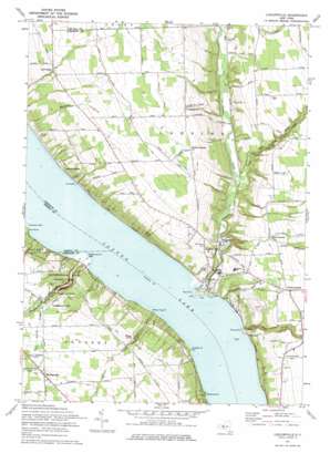
Ludlowville Topo Map New York
To zoom in, hover over the map of Ludlowville
USGS Topo Quad 42076e5 - 1:24,000 scale
| Topo Map Name: | Ludlowville |
| USGS Topo Quad ID: | 42076e5 |
| Print Size: | ca. 21 1/4" wide x 27" high |
| Southeast Coordinates: | 42.5° N latitude / 76.5° W longitude |
| Map Center Coordinates: | 42.5625° N latitude / 76.5625° W longitude |
| U.S. State: | NY |
| Filename: | o42076e5.jpg |
| Download Map JPG Image: | Ludlowville topo map 1:24,000 scale |
| Map Type: | Topographic |
| Topo Series: | 7.5´ |
| Map Scale: | 1:24,000 |
| Source of Map Images: | United States Geological Survey (USGS) |
| Alternate Map Versions: |
Ludlowville NY 1942, updated 1956 Download PDF Buy paper map Ludlowville NY 1942, updated 1961 Download PDF Buy paper map Ludlowville NY 1942, updated 1965 Download PDF Buy paper map Ludlowville NY 1971, updated 1975 Download PDF Buy paper map Ludlowville NY 1971, updated 1975 Download PDF Buy paper map Ludlowville NY 2010 Download PDF Buy paper map Ludlowville NY 2013 Download PDF Buy paper map Ludlowville NY 2016 Download PDF Buy paper map |
1:24,000 Topo Quads surrounding Ludlowville
> Back to 42076e1 at 1:100,000 scale
> Back to 42076a1 at 1:250,000 scale
> Back to U.S. Topo Maps home
Ludlowville topo map: Gazetteer
Ludlowville: Airports
McPherson Seaplane Base elevation 116m 380′Ludlowville: Capes
Crowbar Point elevation 116m 380′Frontenac Point elevation 117m 383′
Lansing Point elevation 121m 396′
Maplewood Point elevation 129m 423′
Myers Point elevation 117m 383′
Portland Point elevation 118m 387′
Taughannock Point elevation 118m 387′
Willow Creek Point elevation 120m 393′
Ludlowville: Falls
Taughannock Falls elevation 205m 672′Ludlowville: Parks
Lansing Park elevation 117m 383′Taughannock Falls State Park elevation 185m 606′
Ludlowville: Populated Places
Jacksonville elevation 312m 1023′Lake Ridge elevation 256m 839′
Lansing Station elevation 123m 403′
Lansingville elevation 312m 1023′
Ludlowville elevation 151m 495′
Myers elevation 148m 485′
Norten elevation 119m 390′
Portland elevation 121m 396′
South Lansing elevation 257m 843′
Taughannock Falls elevation 258m 846′
Willow Creek elevation 220m 721′
Ludlowville: Streams
Cold Spring Branch elevation 236m 774′Gulf Creek elevation 116m 380′
Locke Creek elevation 158m 518′
Minnegar Brook elevation 116m 380′
Morrow Creek elevation 117m 383′
Salmon Creek elevation 116m 380′
Taughannock Creek elevation 116m 380′
Willow Creek elevation 116m 380′
Ludlowville: Valleys
The Gulf elevation 170m 557′Ludlowville digital topo map on disk
Buy this Ludlowville topo map showing relief, roads, GPS coordinates and other geographical features, as a high-resolution digital map file on DVD:
New York, Vermont, Connecticut & Western Massachusetts
Buy digital topo maps: New York, Vermont, Connecticut & Western Massachusetts


