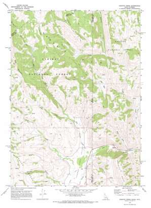
Giraffe Creek Topo Map Idaho
To zoom in, hover over the map of Giraffe Creek
USGS Topo Quad 42111d1 - 1:24,000 scale
| Topo Map Name: | Giraffe Creek |
| USGS Topo Quad ID: | 42111d1 |
| Print Size: | ca. 21 1/4" wide x 27" high |
| Southeast Coordinates: | 42.375° N latitude / 111° W longitude |
| Map Center Coordinates: | 42.4375° N latitude / 111.0625° W longitude |
| U.S. States: | ID, WY |
| Filename: | o42111d1.jpg |
| Download Map JPG Image: | Giraffe Creek topo map 1:24,000 scale |
| Map Type: | Topographic |
| Topo Series: | 7.5´ |
| Map Scale: | 1:24,000 |
| Source of Map Images: | United States Geological Survey (USGS) |
| Alternate Map Versions: |
Giraffe Creek WY 1970, updated 1973 Download PDF Buy paper map Giraffe Creek WY 2011 Download PDF Buy paper map Giraffe Creek WY 2015 Download PDF Buy paper map |
| FStopo: | US Forest Service topo Giraffe Creek is available: Download FStopo PDF Download FStopo TIF |
1:24,000 Topo Quads surrounding Giraffe Creek
> Back to 42111a1 at 1:100,000 scale
> Back to 42110a1 at 1:250,000 scale
> Back to U.S. Topo Maps home
Giraffe Creek topo map: Gazetteer
Giraffe Creek: Basins
Salt Basin elevation 2048m 6719′Giraffe Creek: Ranges
Gannett Hills elevation 2553m 8375′Sublette Range elevation 2392m 7847′
Giraffe Creek: Streams
Dip Creek elevation 1961m 6433′Dry Creek elevation 1899m 6230′
Fish Creek elevation 1961m 6433′
Giraffe Creek elevation 1931m 6335′
Giraffe Creek elevation 1954m 6410′
Preuss Creek elevation 1896m 6220′
Robinson Creek elevation 2141m 7024′
Salt Creek elevation 1905m 6250′
Giraffe Creek: Summits
Table Mountain elevation 2611m 8566′Giraffe Creek: Valleys
Salt Canyon elevation 1907m 6256′Shale Hollow elevation 1937m 6354′
Surnge Canyon elevation 1902m 6240′
Giraffe Creek digital topo map on disk
Buy this Giraffe Creek topo map showing relief, roads, GPS coordinates and other geographical features, as a high-resolution digital map file on DVD:


