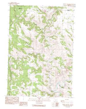
Johnny Cake Mountain Topo Map Oregon
To zoom in, hover over the map of Johnny Cake Mountain
USGS Topo Quad 44119h4 - 1:24,000 scale
| Topo Map Name: | Johnny Cake Mountain |
| USGS Topo Quad ID: | 44119h4 |
| Print Size: | ca. 21 1/4" wide x 27" high |
| Southeast Coordinates: | 44.875° N latitude / 119.375° W longitude |
| Map Center Coordinates: | 44.9375° N latitude / 119.4375° W longitude |
| U.S. State: | OR |
| Filename: | o44119h4.jpg |
| Download Map JPG Image: | Johnny Cake Mountain topo map 1:24,000 scale |
| Map Type: | Topographic |
| Topo Series: | 7.5´ |
| Map Scale: | 1:24,000 |
| Source of Map Images: | United States Geological Survey (USGS) |
| Alternate Map Versions: |
Johnny Cake Mtn OR 1990, updated 1990 Download PDF Buy paper map Johnny Cake Mountain OR 1995, updated 1998 Download PDF Buy paper map Johnny Cake Mountain OR 2011 Download PDF Buy paper map Johnny Cake Mountain OR 2014 Download PDF Buy paper map |
| FStopo: | US Forest Service topo Johnny Cake Mountain is available: Download FStopo PDF Download FStopo TIF |
1:24,000 Topo Quads surrounding Johnny Cake Mountain
> Back to 44119e1 at 1:100,000 scale
> Back to 44118a1 at 1:250,000 scale
> Back to U.S. Topo Maps home
Johnny Cake Mountain topo map: Gazetteer
Johnny Cake Mountain: Flats
Gilman Flat elevation 1112m 3648′Johnny Cake Mountain: Post Offices
Top Post Office (historical) elevation 955m 3133′Johnny Cake Mountain: Springs
Buckhorn Spring elevation 1120m 3674′Tonto Spring elevation 1110m 3641′
Johnny Cake Mountain: Streams
Bacon Creek elevation 923m 3028′Big Wall Creek elevation 682m 2237′
Board Creek elevation 643m 2109′
East Fork Indian Creek elevation 866m 2841′
Fern Creek elevation 672m 2204′
Indian Creek elevation 783m 2568′
Little Wall Creek elevation 696m 2283′
Lovlett Creek elevation 933m 3061′
Scott Creek elevation 770m 2526′
Skookum Creek elevation 787m 2582′
Swale Creek elevation 882m 2893′
Two Cabin Creek elevation 634m 2080′
Wall Creek elevation 629m 2063′
Johnny Cake Mountain: Summits
Johnny Cake Mountain elevation 1089m 3572′Neal Butte elevation 1057m 3467′
Johnny Cake Mountain: Trails
Minetop Trail elevation 1096m 3595′Johnny Cake Mountain: Valleys
Black Rock Canyon elevation 711m 2332′Boneyard Canyon elevation 739m 2424′
Coyote Canyon elevation 642m 2106′
East Fork Boneyard Canyon elevation 792m 2598′
Gilman Canyon elevation 757m 2483′
Mulligan Stew Canyon elevation 804m 2637′
Johnny Cake Mountain digital topo map on disk
Buy this Johnny Cake Mountain topo map showing relief, roads, GPS coordinates and other geographical features, as a high-resolution digital map file on DVD:


