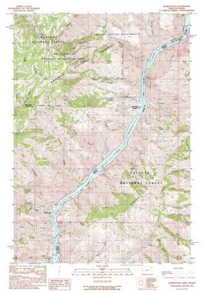
Homestead Topo Map Oregon
To zoom in, hover over the map of Homestead
USGS Topo Quad 45116a7 - 1:24,000 scale
| Topo Map Name: | Homestead |
| USGS Topo Quad ID: | 45116a7 |
| Print Size: | ca. 21 1/4" wide x 27" high |
| Southeast Coordinates: | 45° N latitude / 116.75° W longitude |
| Map Center Coordinates: | 45.0625° N latitude / 116.8125° W longitude |
| U.S. States: | OR, ID |
| Filename: | o45116a7.jpg |
| Download Map JPG Image: | Homestead topo map 1:24,000 scale |
| Map Type: | Topographic |
| Topo Series: | 7.5´ |
| Map Scale: | 1:24,000 |
| Source of Map Images: | United States Geological Survey (USGS) |
| Alternate Map Versions: |
Homestead OR 1990, updated 1990 Download PDF Buy paper map Homestead OR 2004, updated 2007 Download PDF Buy paper map Homestead OR 2011 Download PDF Buy paper map Homestead OR 2014 Download PDF Buy paper map |
| FStopo: | US Forest Service topo Homestead is available: Download FStopo PDF Download FStopo TIF |
1:24,000 Topo Quads surrounding Homestead
> Back to 45116a1 at 1:100,000 scale
> Back to 45116a1 at 1:250,000 scale
> Back to U.S. Topo Maps home
Homestead topo map: Gazetteer
Homestead: Mines
Irondyke Mine elevation 679m 2227′Homestead: Parks
Hells Canyon Park elevation 967m 3172′Homestead: Populated Places
Homestead elevation 536m 1758′Homestead: Post Offices
Homestead Post Office (historical) elevation 536m 1758′Landing Post Office (historical) elevation 798m 2618′
Homestead: Rapids
Cattle Rapids elevation 514m 1686′Cattle Rapids elevation 514m 1686′
Kerrs Rapids elevation 514m 1686′
Kerrs Rapids elevation 514m 1686′
Homestead: Ridges
Windy Ridge elevation 1293m 4242′Homestead: Springs
Rock Spring elevation 1645m 5396′Homestead: Streams
Ashby Creek elevation 514m 1686′Ballard Creek elevation 514m 1686′
Bob Creek elevation 515m 1689′
Boulder Creek elevation 1052m 3451′
Copper Creek elevation 514m 1686′
Degits Creek elevation 962m 3156′
Eckels Creek elevation 515m 1689′
Elk Creek elevation 880m 2887′
Hale Creek elevation 514m 1686′
Herman Creek elevation 514m 1686′
Holbrook Creek elevation 514m 1686′
Homestead Creek elevation 514m 1686′
Irondyke Creek elevation 514m 1686′
Leep Creek elevation 514m 1686′
Limepoint Creek elevation 514m 1686′
McDougal Creek elevation 514m 1686′
McGraw Creek elevation 514m 1686′
Nelson Creek elevation 514m 1686′
South Fork McGraw Creek elevation 710m 2329′
Spring Creek elevation 514m 1686′
Steen Creek elevation 1336m 4383′
West Fork McGraw Creek elevation 1482m 4862′
Homestead: Valleys
Bull Gulch elevation 937m 3074′Hibble Gulch elevation 567m 1860′
Negro Bill Gulch elevation 1122m 3681′
Homestead digital topo map on disk
Buy this Homestead topo map showing relief, roads, GPS coordinates and other geographical features, as a high-resolution digital map file on DVD:


