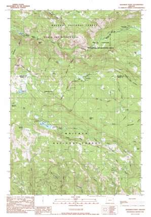
Deadman Point Topo Map Oregon
To zoom in, hover over the map of Deadman Point
USGS Topo Quad 45117a1 - 1:24,000 scale
| Topo Map Name: | Deadman Point |
| USGS Topo Quad ID: | 45117a1 |
| Print Size: | ca. 21 1/4" wide x 27" high |
| Southeast Coordinates: | 45° N latitude / 117° W longitude |
| Map Center Coordinates: | 45.0625° N latitude / 117.0625° W longitude |
| U.S. State: | OR |
| Filename: | o45117a1.jpg |
| Download Map JPG Image: | Deadman Point topo map 1:24,000 scale |
| Map Type: | Topographic |
| Topo Series: | 7.5´ |
| Map Scale: | 1:24,000 |
| Source of Map Images: | United States Geological Survey (USGS) |
| Alternate Map Versions: |
Deadman Point OR 1990, updated 1990 Download PDF Buy paper map Deadman Point OR 2011 Download PDF Buy paper map Deadman Point OR 2014 Download PDF Buy paper map |
| FStopo: | US Forest Service topo Deadman Point is available: Download FStopo PDF Download FStopo TIF |
1:24,000 Topo Quads surrounding Deadman Point
> Back to 45117a1 at 1:100,000 scale
> Back to 45116a1 at 1:250,000 scale
> Back to U.S. Topo Maps home
Deadman Point topo map: Gazetteer
Deadman Point: Canals
Buchanan Ditch elevation 2006m 6581′Greener Ditch elevation 1934m 6345′
Huff Ditch elevation 1634m 5360′
Deadman Point: Cliffs
Deadman Point elevation 2327m 7634′Deadman Point: Dams
Fish Lake Dam elevation 2032m 6666′Sugarloaf Dam elevation 2195m 7201′
Deadman Point: Falls
Imnaha Falls elevation 1591m 5219′Deadman Point: Lakes
Duck Lake elevation 1665m 5462′Fish Lake elevation 2032m 6666′
Horse Lake elevation 1714m 5623′
Lake Frances elevation 2060m 6758′
Lost Lake Reservoir elevation 1875m 6151′
Mud Lake elevation 2155m 7070′
Twin Lakes elevation 1975m 6479′
Warm Lake elevation 1908m 6259′
Deadman Point: Reservoirs
Sugarloaf Reservoir elevation 2195m 7201′Deadman Point: Streams
Aspen Creek elevation 1646m 5400′Big Elk Creek elevation 1722m 5649′
Cabin Creek elevation 1692m 5551′
East Trinity Creek elevation 1619m 5311′
Fish Lake Branch elevation 1835m 6020′
Lick Creek elevation 1772m 5813′
Pole Creek elevation 1499m 4917′
Pole Creek elevation 1405m 4609′
Rock Creek elevation 1553m 5095′
West Trinity Creek elevation 1535m 5036′
Deadman Point: Summits
Gobblers Knob elevation 2000m 6561′Russel Mountain elevation 2286m 7500′
Deadman Point: Valleys
Deadman Canyon elevation 1599m 5246′Moody Basin elevation 1568m 5144′
Deadman Point digital topo map on disk
Buy this Deadman Point topo map showing relief, roads, GPS coordinates and other geographical features, as a high-resolution digital map file on DVD:


