Mcconnell Mountain Topo Map Idaho
To zoom in, hover over the map of Mcconnell Mountain
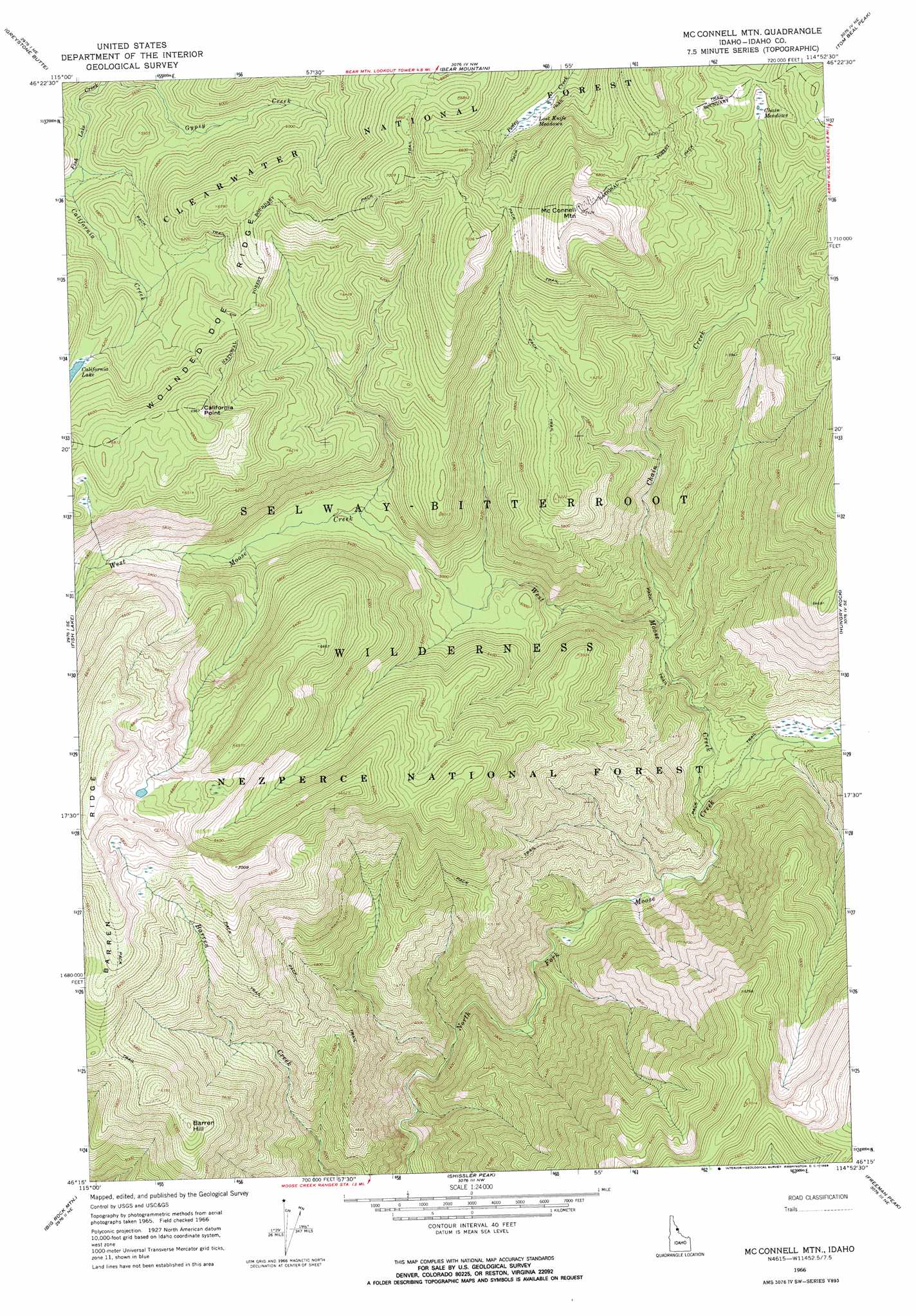
USGS Topo Quad 46114c8 - 1:24,000 scale
| Topo Map Name: | Mcconnell Mountain |
| USGS Topo Quad ID: | 46114c8 |
| Print Size: | ca. 21 1/4" wide x 27" high |
| Southeast Coordinates: | 46.25° N latitude / 114.875° W longitude |
| Map Center Coordinates: | 46.3125° N latitude / 114.9375° W longitude |
| U.S. State: | ID |
| Filename: | o46114c8.jpg |
| Download Map JPG Image: | Mcconnell Mountain topo map 1:24,000 scale |
| Map Type: | Topographic |
| Topo Series: | 7.5´ |
| Map Scale: | 1:24,000 |
| Source of Map Images: | United States Geological Survey (USGS) |
| Alternate Map Versions: |
Mc Connell Mtn ID 1966, updated 1968 Download PDF Buy paper map Mc Connell Mtn ID 1966, updated 1969 Download PDF Buy paper map Mc Connell Mountain ID 1995, updated 1999 Download PDF Buy paper map McConnell Mountain ID 2011 Download PDF Buy paper map McConnell Mountain ID 2013 Download PDF Buy paper map |
| FStopo: | US Forest Service topo McConnell Mountain is available: Download FStopo PDF Download FStopo TIF |
1:24,000 Topo Quads surrounding Mcconnell Mountain
Lookout Peak |
Horseshoe Lake |
Indian Postoffice |
Cayuse Junction |
Rocky Point |
Holly Creek |
Greystone Butte |
Bear Mountain |
Tom Beal Peak |
Grave Peak |
Greenside Butte |
Fish Lake |
Mcconnell Mountain |
Hungry Rock |
Cedar Ridge |
Fenn Mountain |
Big Rock Mountain |
Shissler Peak |
Freeman Peak |
Wahoo Peak |
Fog Mountain |
Mink Peak |
Moose Ridge |
Dog Creek |
Twin Butte |
> Back to 46114a1 at 1:100,000 scale
> Back to 46114a1 at 1:250,000 scale
> Back to U.S. Topo Maps home
Mcconnell Mountain topo map: Gazetteer
Mcconnell Mountain: Cliffs
California Point elevation 2122m 6961′Mcconnell Mountain: Flats
Chain Meadows elevation 1822m 5977′Lost Knife Meadows elevation 1837m 6026′
Mcconnell Mountain: Ridges
Wounded Doe Ridge elevation 1943m 6374′Mcconnell Mountain: Streams
California Creek elevation 1671m 5482′Chain Creek elevation 1305m 4281′
West Moose Creek elevation 1212m 3976′
Mcconnell Mountain: Summits
Barren Hill elevation 1888m 6194′McConnell Mountain elevation 2259m 7411′
Mcconnell Mountain digital topo map on disk
Buy this Mcconnell Mountain topo map showing relief, roads, GPS coordinates and other geographical features, as a high-resolution digital map file on DVD: