Hungry Rock Topo Map Idaho
To zoom in, hover over the map of Hungry Rock
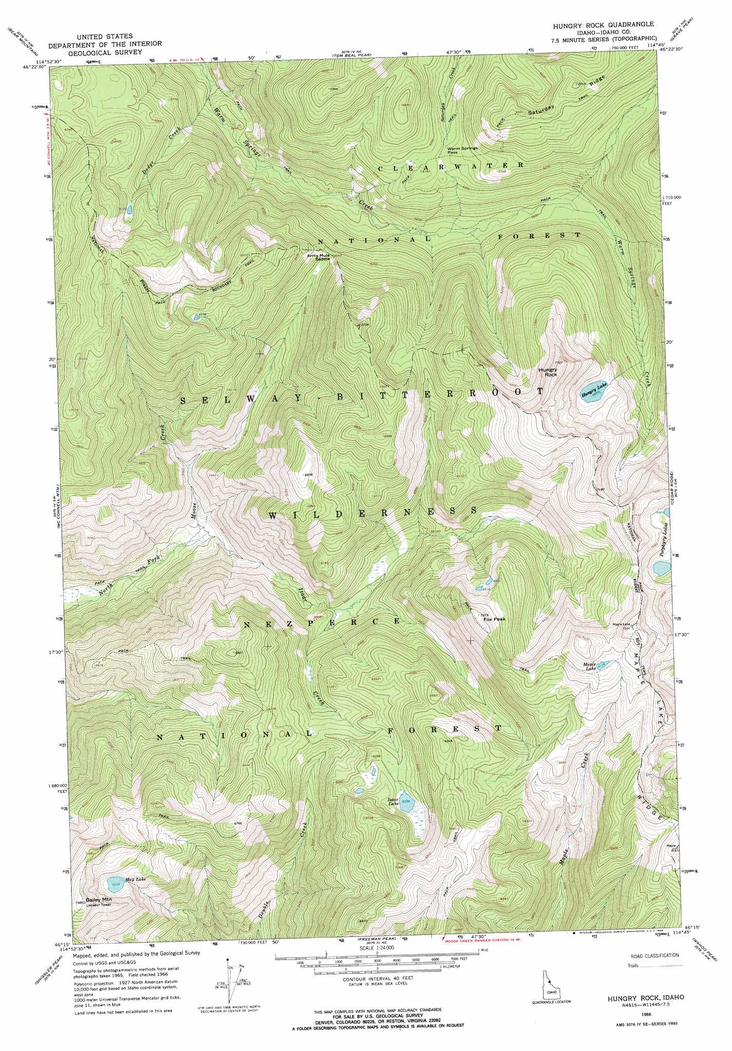
USGS Topo Quad 46114c7 - 1:24,000 scale
| Topo Map Name: | Hungry Rock |
| USGS Topo Quad ID: | 46114c7 |
| Print Size: | ca. 21 1/4" wide x 27" high |
| Southeast Coordinates: | 46.25° N latitude / 114.75° W longitude |
| Map Center Coordinates: | 46.3125° N latitude / 114.8125° W longitude |
| U.S. State: | ID |
| Filename: | o46114c7.jpg |
| Download Map JPG Image: | Hungry Rock topo map 1:24,000 scale |
| Map Type: | Topographic |
| Topo Series: | 7.5´ |
| Map Scale: | 1:24,000 |
| Source of Map Images: | United States Geological Survey (USGS) |
| Alternate Map Versions: |
Hungry Rock ID 1966, updated 1968 Download PDF Buy paper map Hungry Rock ID 1966, updated 1969 Download PDF Buy paper map Hungry Rock ID 1995, updated 1999 Download PDF Buy paper map Hungry Rock ID 2011 Download PDF Buy paper map Hungry Rock ID 2013 Download PDF Buy paper map |
| FStopo: | US Forest Service topo Hungry Rock is available: Download FStopo PDF Download FStopo TIF |
1:24,000 Topo Quads surrounding Hungry Rock
Horseshoe Lake |
Indian Postoffice |
Cayuse Junction |
Rocky Point |
Roundtop |
Greystone Butte |
Bear Mountain |
Tom Beal Peak |
Grave Peak |
Savage Ridge |
Fish Lake |
Mcconnell Mountain |
Hungry Rock |
Cedar Ridge |
Jeanette Mountain |
Big Rock Mountain |
Shissler Peak |
Freeman Peak |
Wahoo Peak |
Saddle Mountain |
Mink Peak |
Moose Ridge |
Dog Creek |
Twin Butte |
Hunter Peak |
> Back to 46114a1 at 1:100,000 scale
> Back to 46114a1 at 1:250,000 scale
> Back to U.S. Topo Maps home
Hungry Rock topo map: Gazetteer
Hungry Rock: Cliffs
Hungry Rock elevation 2352m 7716′Hungry Rock: Gaps
Warm Springs Pass elevation 1869m 6131′Hungry Rock: Lakes
Dodge Lake elevation 1883m 6177′Hungry Lake elevation 2038m 6686′
Isaac Lake elevation 1896m 6220′
Maple Lake elevation 2180m 7152′
May Lake elevation 2030m 6660′
Porphyry Lake elevation 2119m 6952′
Hungry Rock: Ridges
Maple Lake Ridge elevation 2201m 7221′Saturday Ridge elevation 2138m 7014′
Hungry Rock: Streams
Dodge Creek elevation 1540m 5052′Isaac Creek elevation 1380m 4527′
Hungry Rock: Summits
Bailey Mountain elevation 2254m 7395′Fox Peak elevation 2214m 7263′
Hungry Rock digital topo map on disk
Buy this Hungry Rock topo map showing relief, roads, GPS coordinates and other geographical features, as a high-resolution digital map file on DVD: