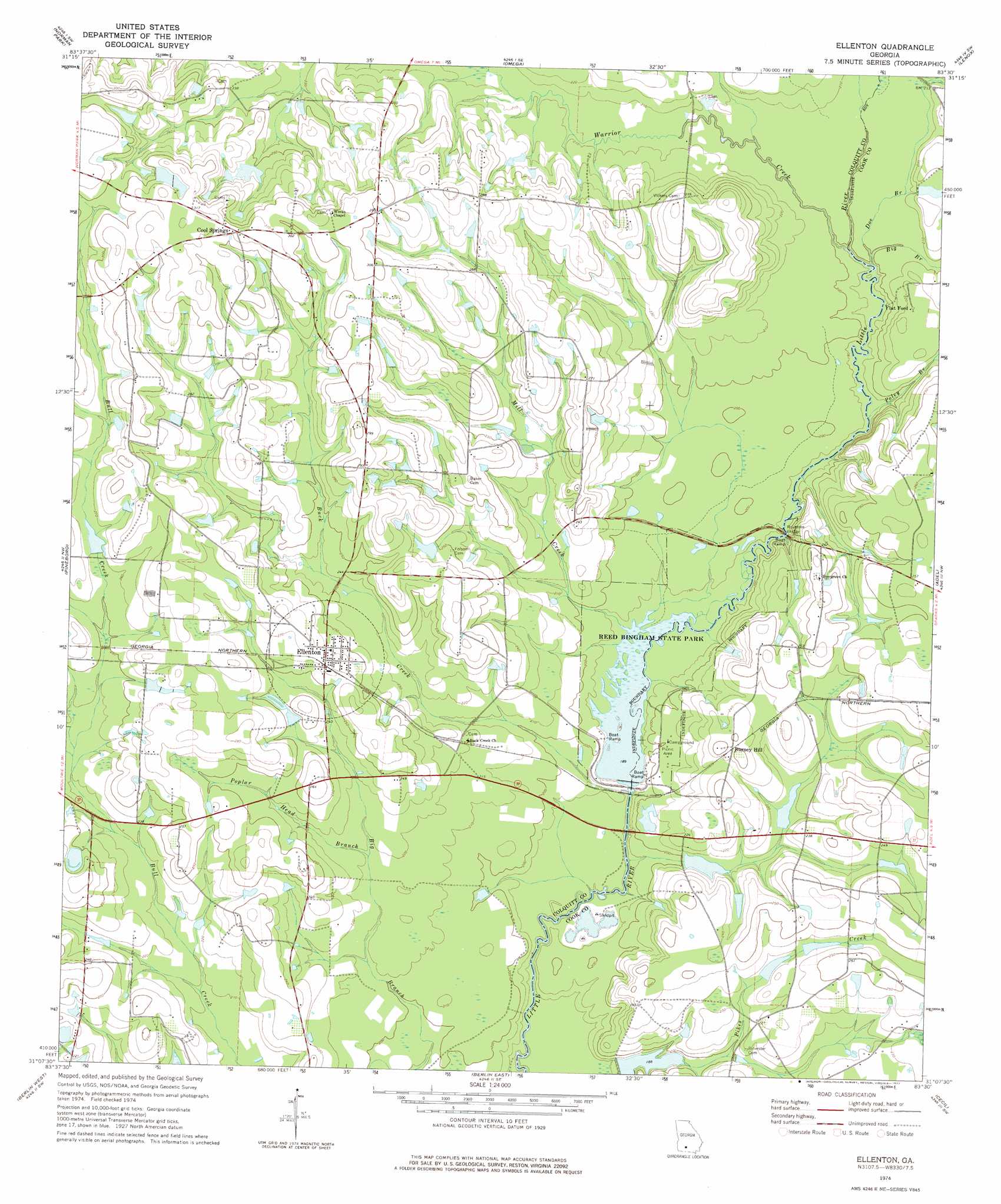
Ellenton Topo Map Georgia
To zoom in, hover over the map of Ellenton
USGS Topo Quad 31083b5 - 1:24,000 scale
| Topo Map Name: | Ellenton |
| USGS Topo Quad ID: | 31083b5 |
| Print Size: | ca. 21 1/4" wide x 27" high |
| Southeast Coordinates: | 31.125° N latitude / 83.5° W longitude |
| Map Center Coordinates: | 31.1875° N latitude / 83.5625° W longitude |
| U.S. State: | GA |
| Filename: | o31083b5.jpg |
| Download Map JPG Image: | Ellenton topo map 1:24,000 scale |
| Map Type: | Topographic |
| Topo Series: | 7.5´ |
| Map Scale: | 1:24,000 |
| Source of Map Images: | United States Geological Survey (USGS) |
| Alternate Map Versions: |
Ellenton GA 1974, updated 1977 Download PDF Buy paper map Ellenton GA 2011 Download PDF Buy paper map Ellenton GA 2014 Download PDF Buy paper map |
1:24,000 Topo Quads surrounding Ellenton
Tempy |
Ty Ty |
Tifton West |
Tifton East |
Enigma |
Sigsbee |
Norman Park |
Omega |
Lenox |
Sapps Lake |
Moultrie |
Pineboro |
Ellenton |
Adel |
Nashville West |
Coolidge |
Berlin West |
Berlin East |
Cecil |
New Lois |
Patten |
Pavo |
Pebble Hill |
Hahira West |
Hahira East |
> Back to 31083a1 at 1:100,000 scale
> Back to 31082a1 at 1:250,000 scale
> Back to U.S. Topo Maps home
Ellenton topo map: Gazetteer
Ellenton: Bridges
Rountree Bridge elevation 58m 190′Whitehurst Bridge elevation 54m 177′
Ellenton: Dams
Grist Lake Dam elevation 69m 226′Pervis Lake Dam elevation 62m 203′
Reed Bingham Park Lake Dam elevation 57m 187′
Saunders Lake Dam elevation 57m 187′
Vickers Lake Dam elevation 92m 301′
Ellenton: Parks
Reed Bingham State Park elevation 60m 196′Ellenton: Populated Places
Bayboro (historical) elevation 68m 223′Burney Hill elevation 75m 246′
Cool Springs elevation 96m 314′
Ellenton elevation 80m 262′
Flat Ford elevation 68m 223′
Nola (historical) elevation 78m 255′
Ellenton: Reservoirs
Grist Lake elevation 69m 226′Pervis Lake elevation 62m 203′
Reed Bingham Park Lake elevation 57m 187′
Saunders Lake elevation 57m 187′
Vickers Lake elevation 92m 301′
Ellenton: Streams
Big Branch elevation 58m 190′Buck Creek elevation 55m 180′
Doe Branch elevation 59m 193′
Flat Branch elevation 62m 203′
Gum Creek elevation 63m 206′
Mill Creek elevation 58m 190′
Poley Branch elevation 58m 190′
Poplar Head Branch elevation 66m 216′
Warrior Creek elevation 58m 190′
Ellenton digital topo map on disk
Buy this Ellenton topo map showing relief, roads, GPS coordinates and other geographical features, as a high-resolution digital map file on DVD: