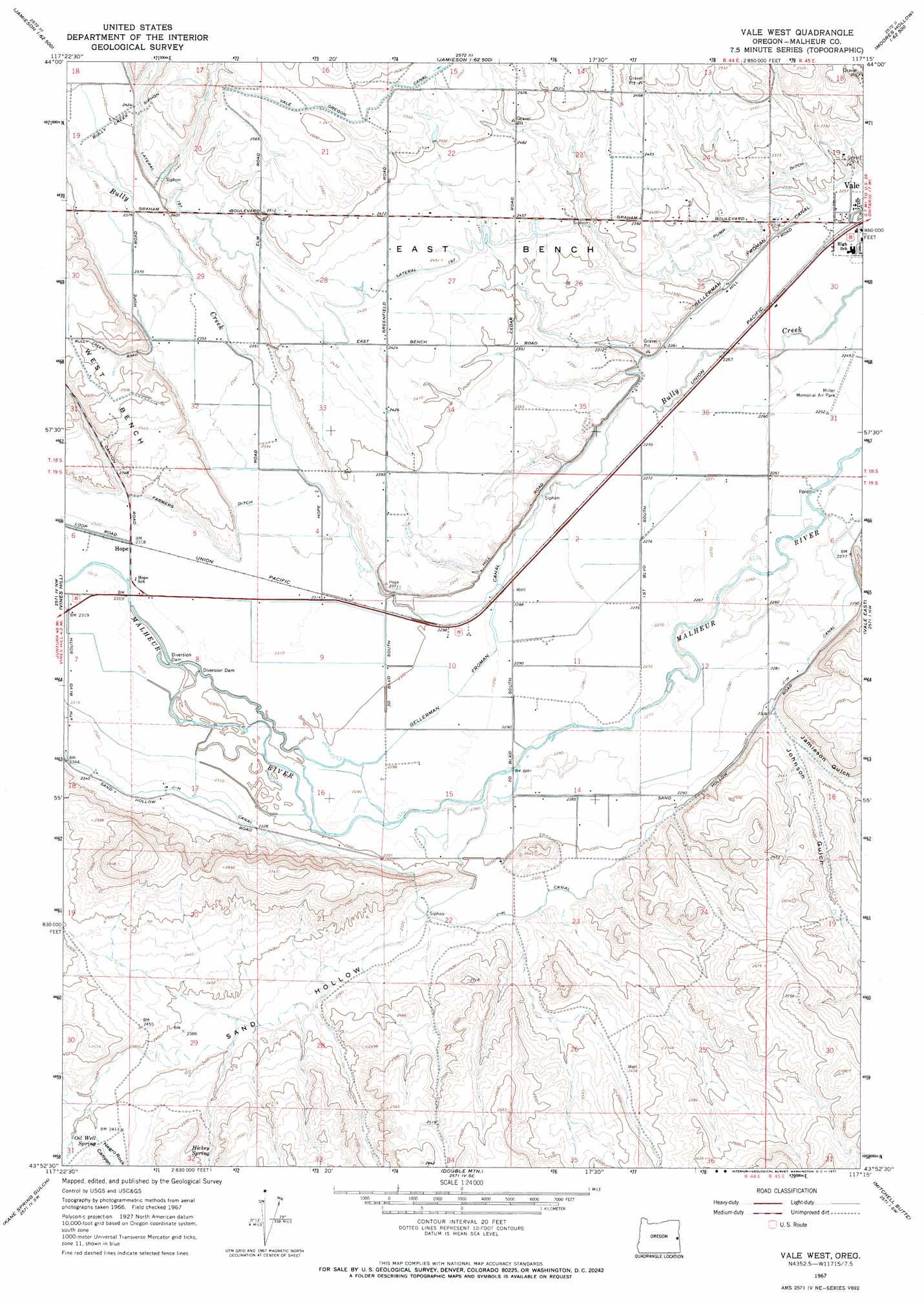
Vale West Topo Map Oregon
To zoom in, hover over the map of Vale West
USGS Topo Quad 43117h3 - 1:24,000 scale
| Topo Map Name: | Vale West |
| USGS Topo Quad ID: | 43117h3 |
| Print Size: | ca. 21 1/4" wide x 27" high |
| Southeast Coordinates: | 43.875° N latitude / 117.25° W longitude |
| Map Center Coordinates: | 43.9375° N latitude / 117.3125° W longitude |
| U.S. State: | OR |
| Filename: | o43117h3.jpg |
| Download Map JPG Image: | Vale West topo map 1:24,000 scale |
| Map Type: | Topographic |
| Topo Series: | 7.5´ |
| Map Scale: | 1:24,000 |
| Source of Map Images: | United States Geological Survey (USGS) |
| Alternate Map Versions: |
Vale West OR 1967, updated 1971 Download PDF Buy paper map Vale West OR 2011 Download PDF Buy paper map Vale West OR 2014 Download PDF Buy paper map |
1:24,000 Topo Quads surrounding Vale West
Brogan |
Jamieson |
Mccarthy Ridge |
Tub Mountain |
Moores Hollow |
Swede Flat |
Hope Butte |
Willow Creek |
Henry Gulch |
Malheur Butte |
Little Valley |
Vines Hill |
Vale West |
Vale East |
Cairo |
Harper |
Kane Spring Gulch |
Double Mountain |
Mitchell Butte |
Owyhee |
Keeney Ridge |
Sourdough Spring |
Grassy Mountain |
Owyhee Dam |
Adrian |
> Back to 43117e1 at 1:100,000 scale
> Back to 43116a1 at 1:250,000 scale
> Back to U.S. Topo Maps home
Vale West topo map: Gazetteer
Vale West: Airports
Miller Memorial Airpark elevation 691m 2267′Vale West: Benches
East Bench elevation 738m 2421′Vale West: Canals
Boston Drain elevation 702m 2303′Bully Creek Siphon elevation 736m 2414′
Farmers Ditch elevation 714m 2342′
J-H Canal elevation 708m 2322′
Lateral 197 elevation 730m 2395′
Pump Ditch elevation 715m 2345′
Purvis Drain elevation 705m 2312′
Robbins Drain elevation 705m 2312′
Russell Drain elevation 694m 2276′
Vale Oregon Main Canal elevation 783m 2568′
Vale West: Populated Places
Paris (historical) elevation 703m 2306′Vale West: Post Offices
Grove City Post Office (historical) elevation 705m 2312′Vale West: Reservoirs
Johnston Gulch Reservoir elevation 735m 2411′Vale West: Springs
Hickey Spring elevation 750m 2460′Oil Well Spring elevation 738m 2421′
Vale West: Valleys
Fairman Coulee elevation 736m 2414′Jamieson Gulch elevation 707m 2319′
Johnson Gulch elevation 703m 2306′
Negro Rock Canyon elevation 736m 2414′
Sand Hollow elevation 708m 2322′
Vale West digital topo map on disk
Buy this Vale West topo map showing relief, roads, GPS coordinates and other geographical features, as a high-resolution digital map file on DVD: