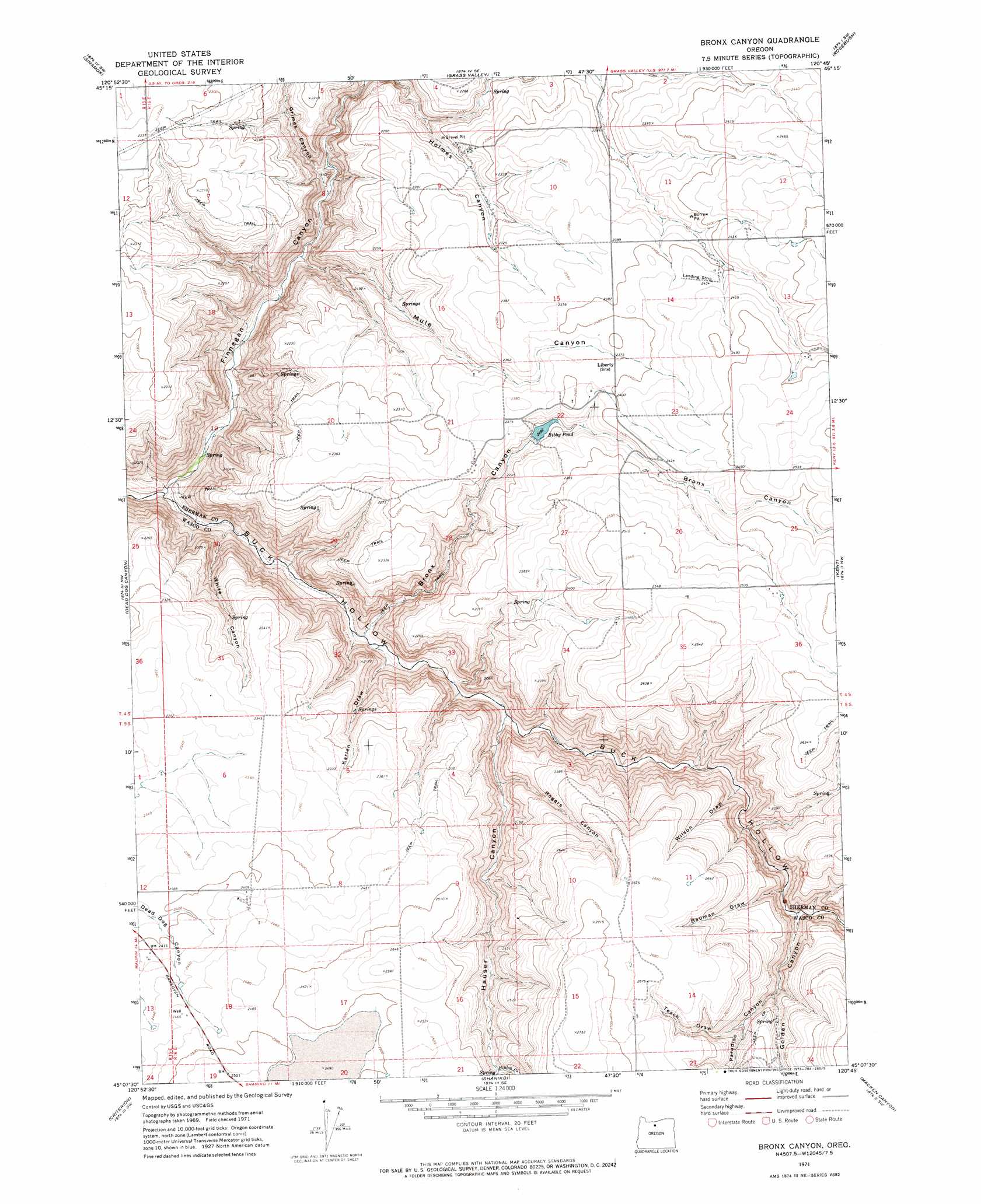
Bronx Canyon Topo Map Oregon
To zoom in, hover over the map of Bronx Canyon
USGS Topo Quad 45120b7 - 1:24,000 scale
| Topo Map Name: | Bronx Canyon |
| USGS Topo Quad ID: | 45120b7 |
| Print Size: | ca. 21 1/4" wide x 27" high |
| Southeast Coordinates: | 45.125° N latitude / 120.75° W longitude |
| Map Center Coordinates: | 45.1875° N latitude / 120.8125° W longitude |
| U.S. State: | OR |
| Filename: | o45120b7.jpg |
| Download Map JPG Image: | Bronx Canyon topo map 1:24,000 scale |
| Map Type: | Topographic |
| Topo Series: | 7.5´ |
| Map Scale: | 1:24,000 |
| Source of Map Images: | United States Geological Survey (USGS) |
| Alternate Map Versions: |
Bronx Canyon OR 1971, updated 1973 Download PDF Buy paper map Bronx Canyon OR 2011 Download PDF Buy paper map Bronx Canyon OR 2014 Download PDF Buy paper map |
1:24,000 Topo Quads surrounding Bronx Canyon
Dufur East |
Summit Ridge |
Erskine |
Moro |
Harmony |
Sherars Bridge |
Sinamox |
Grass Valley |
Rosebush |
Indian Cove |
Maupin |
Dead Dog Canyon |
Bronx Canyon |
Kent |
Horseshoe Bend |
Dant |
Criterion |
Shaniko |
Macken Canyon |
Bath Canyon |
Kaskela |
Shaniko Junction |
Shaniko Summit |
Antelope |
Hastings Peak |
> Back to 45120a1 at 1:100,000 scale
> Back to 45120a1 at 1:250,000 scale
> Back to U.S. Topo Maps home
Bronx Canyon topo map: Gazetteer
Bronx Canyon: Dams
Bibby Dam elevation 776m 2545′Bronx Canyon: Reservoirs
Bibby Pond elevation 696m 2283′Bronx Canyon: Streams
Finnegan Creek elevation 450m 1476′Hinton Creek elevation 717m 2352′
Bronx Canyon: Valleys
Bauman Draw elevation 644m 2112′Bronx Canyon elevation 502m 1646′
Finnegan Canyon elevation 454m 1489′
Golden Canyon elevation 630m 2066′
Grimes Canyon elevation 547m 1794′
Hauser Canyon elevation 536m 1758′
Karlen Draw elevation 520m 1706′
Mule Canyon elevation 532m 1745′
Paradise Canyon elevation 708m 2322′
Rogers Canyon elevation 591m 1938′
Tesch Draw elevation 728m 2388′
White Canyon elevation 469m 1538′
Wilson Draw elevation 595m 1952′
Bronx Canyon digital topo map on disk
Buy this Bronx Canyon topo map showing relief, roads, GPS coordinates and other geographical features, as a high-resolution digital map file on DVD: