Dark Lake Topo Map Minnesota
To zoom in, hover over the map of Dark Lake
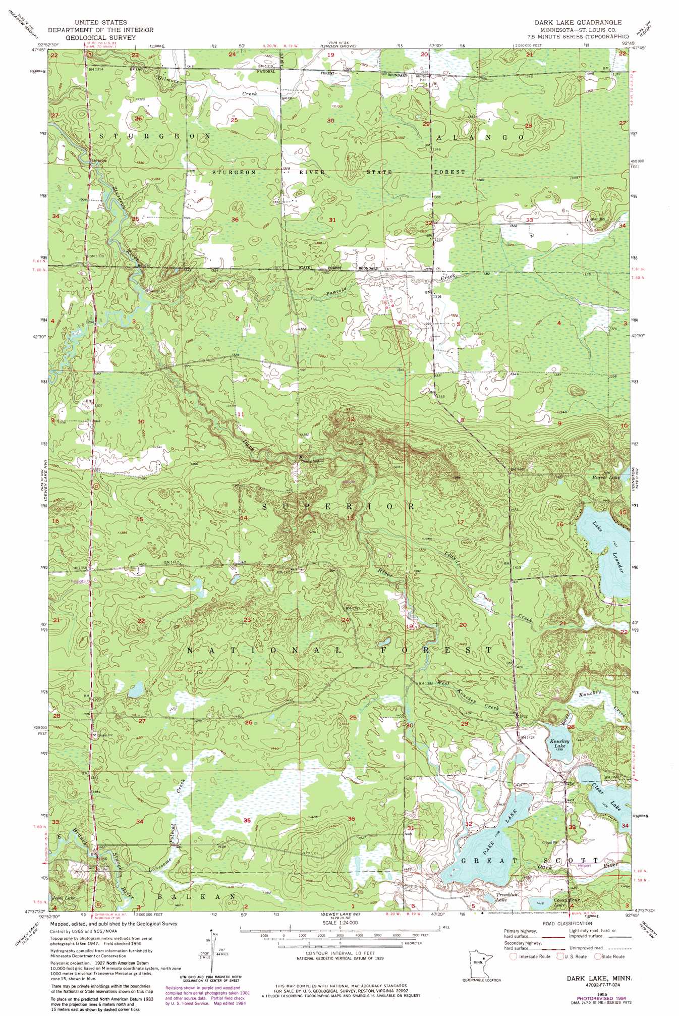
USGS Topo Quad 47092f7 - 1:24,000 scale
| Topo Map Name: | Dark Lake |
| USGS Topo Quad ID: | 47092f7 |
| Print Size: | ca. 21 1/4" wide x 27" high |
| Southeast Coordinates: | 47.625° N latitude / 92.75° W longitude |
| Map Center Coordinates: | 47.6875° N latitude / 92.8125° W longitude |
| U.S. State: | MN |
| Filename: | o47092f7.jpg |
| Download Map JPG Image: | Dark Lake topo map 1:24,000 scale |
| Map Type: | Topographic |
| Topo Series: | 7.5´ |
| Map Scale: | 1:24,000 |
| Source of Map Images: | United States Geological Survey (USGS) |
| Alternate Map Versions: |
Dark Lake MN 1955, updated 1956 Download PDF Buy paper map Dark Lake MN 1955, updated 1985 Download PDF Buy paper map Dark Lake MN 1955, updated 1985 Download PDF Buy paper map Dark Lake MN 2011 Download PDF Buy paper map Dark Lake MN 2013 Download PDF Buy paper map Dark Lake MN 2016 Download PDF Buy paper map |
| FStopo: | US Forest Service topo Dark Lake is available: Download FStopo PDF Download FStopo TIF |
1:24,000 Topo Quads surrounding Dark Lake
Silverdale |
Gheen Nw |
Gheen |
Haley |
Norwegian Bay |
Bear River |
Meadow Brook |
Linden Grove |
Cook |
Sassas Creek |
Side Lake |
Dewey Lake Nw |
Dark Lake |
Idington |
Britt |
Stingy Lake |
Dewey Lake |
Dewey Lake Se |
Kinney |
Virginia |
Keewatin |
Hibbing |
Buhl |
Kirk |
Eveleth |
> Back to 47092e1 at 1:100,000 scale
> Back to 47092a1 at 1:250,000 scale
> Back to U.S. Topo Maps home
Dark Lake topo map: Gazetteer
Dark Lake: Lakes
Camp Four Lake elevation 433m 1420′Clear Lake elevation 429m 1407′
Dark Lake elevation 426m 1397′
Knuckey Lake elevation 426m 1397′
Lake Leander elevation 436m 1430′
Tremblon Lake elevation 429m 1407′
Dark Lake: Parks
Sturgeon River Wayside Park elevation 390m 1279′Dark Lake: Streams
Dark River elevation 391m 1282′East Knuckey Creek elevation 426m 1397′
Leander Creek elevation 408m 1338′
Lonesome Polecat Creek elevation 416m 1364′
Murray Creek elevation 393m 1289′
Paavola Creek elevation 391m 1282′
West Knuckey Creek elevation 421m 1381′
Dark Lake digital topo map on disk
Buy this Dark Lake topo map showing relief, roads, GPS coordinates and other geographical features, as a high-resolution digital map file on DVD: