Donie Topo Map Texas
To zoom in, hover over the map of Donie
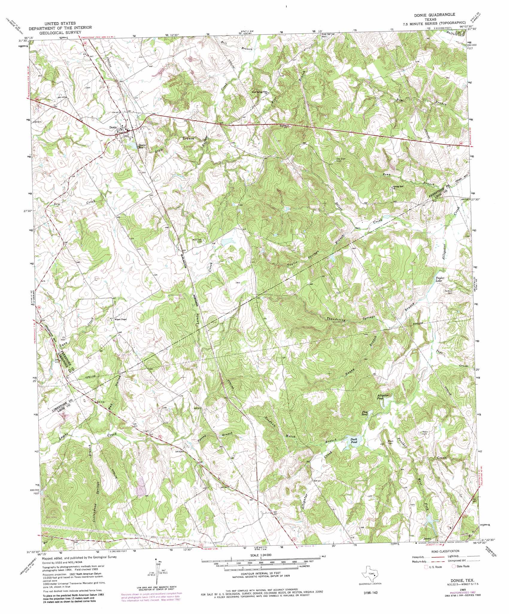
USGS Topo Quad 31096d2 - 1:24,000 scale
| Topo Map Name: | Donie |
| USGS Topo Quad ID: | 31096d2 |
| Print Size: | ca. 21 1/4" wide x 27" high |
| Southeast Coordinates: | 31.375° N latitude / 96.125° W longitude |
| Map Center Coordinates: | 31.4375° N latitude / 96.1875° W longitude |
| U.S. State: | TX |
| Filename: | o31096d2.jpg |
| Download Map JPG Image: | Donie topo map 1:24,000 scale |
| Map Type: | Topographic |
| Topo Series: | 7.5´ |
| Map Scale: | 1:24,000 |
| Source of Map Images: | United States Geological Survey (USGS) |
| Alternate Map Versions: |
Donie TX 1965, updated 1968 Download PDF Buy paper map Donie TX 1965, updated 1983 Download PDF Buy paper map Donie TX 2010 Download PDF Buy paper map Donie TX 2013 Download PDF Buy paper map Donie TX 2016 Download PDF Buy paper map |
1:24,000 Topo Quads surrounding Donie
Mexia |
Teague North |
Fairfield |
Turlington |
Butler |
Fallon |
Teague South |
Dew |
Lanely |
Keechi |
Box Church |
Farrar |
Donie |
Buffalo |
Flo |
Oletha |
Round Prairie |
Jewett |
Robbins |
Centerville |
Bald Prairie |
Marquez |
Margie |
Spring Seat |
Leona |
> Back to 31096a1 at 1:100,000 scale
> Back to 31096a1 at 1:250,000 scale
> Back to U.S. Topo Maps home
Donie topo map: Gazetteer
Donie: Airports
Hub Field elevation 122m 400′Donie: Lakes
Alligator Pond elevation 110m 360′Duck Pond elevation 112m 367′
Flag Pond elevation 110m 360′
Taylor Lake elevation 99m 324′
Donie: Populated Places
Donie elevation 149m 488′Donie: Reservoirs
Donie Reservoir elevation 146m 479′Donie: Streams
Alum Branch elevation 119m 390′Cottonwood Springs Branch elevation 119m 390′
Nanny Branch elevation 107m 351′
Needham Marsh Branch elevation 112m 367′
Panther Creek elevation 110m 360′
Silver Creek elevation 94m 308′
Spring Branch elevation 125m 410′
Tape Creek elevation 105m 344′
Taylor Springs Branch elevation 109m 357′
Thundering Springs Branch elevation 99m 324′
West Fork Panther Creek elevation 115m 377′
Donie: Valleys
Red Hollow elevation 122m 400′Donie: Wells
Riley Springs Well elevation 110m 360′Donie digital topo map on disk
Buy this Donie topo map showing relief, roads, GPS coordinates and other geographical features, as a high-resolution digital map file on DVD: