Dew Topo Map Texas
To zoom in, hover over the map of Dew
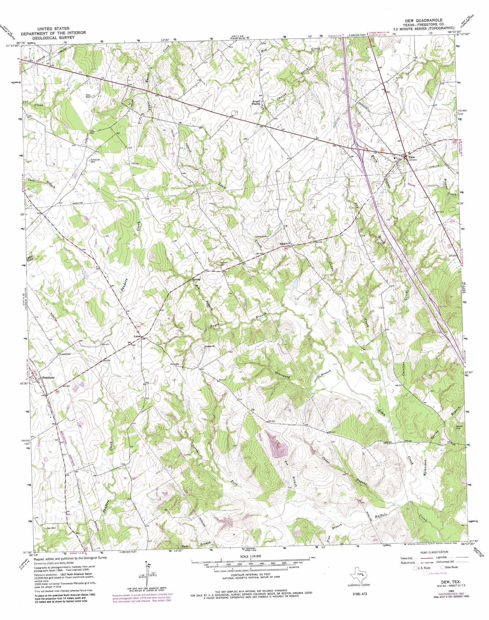
USGS Topo Quad 31096e2 - 1:24,000 scale
| Topo Map Name: | Dew |
| USGS Topo Quad ID: | 31096e2 |
| Print Size: | ca. 21 1/4" wide x 27" high |
| Southeast Coordinates: | 31.5° N latitude / 96.125° W longitude |
| Map Center Coordinates: | 31.5625° N latitude / 96.1875° W longitude |
| U.S. State: | TX |
| Filename: | o31096e2.jpg |
| Download Map JPG Image: | Dew topo map 1:24,000 scale |
| Map Type: | Topographic |
| Topo Series: | 7.5´ |
| Map Scale: | 1:24,000 |
| Source of Map Images: | United States Geological Survey (USGS) |
| Alternate Map Versions: |
Dew TX 1965, updated 1967 Download PDF Buy paper map Dew TX 1965, updated 1983 Download PDF Buy paper map Dew TX 2010 Download PDF Buy paper map Dew TX 2013 Download PDF Buy paper map Dew TX 2016 Download PDF Buy paper map |
1:24,000 Topo Quads surrounding Dew
Wortham |
Kirvin |
Stewards Mill |
Young |
Yard |
Mexia |
Teague North |
Fairfield |
Turlington |
Butler |
Fallon |
Teague South |
Dew |
Lanely |
Keechi |
Box Church |
Farrar |
Donie |
Buffalo |
Flo |
Oletha |
Round Prairie |
Jewett |
Robbins |
Centerville |
> Back to 31096e1 at 1:100,000 scale
> Back to 31096a1 at 1:250,000 scale
> Back to U.S. Topo Maps home
Dew topo map: Gazetteer
Dew: Dams
Hunt Ranch Lake Dam Number 1 elevation 124m 406′Hunt Ranch Lake Dam Number 2 elevation 115m 377′
Dew: Populated Places
Avant Prairie elevation 138m 452′Dew elevation 141m 462′
Freestone elevation 153m 501′
Luna elevation 152m 498′
Dew: Reservoirs
Hunt Ranch Lake Number 1 elevation 124m 406′Hunt Ranch Lake Number 2 elevation 115m 377′
Dew: Streams
Bee Branch elevation 103m 337′Bell Branch elevation 116m 380′
Blain Dugout elevation 128m 419′
Bob Branch elevation 119m 390′
Caroline Creek elevation 98m 321′
Cedar Creek elevation 101m 331′
Cedar Dugout elevation 98m 321′
Church Creek elevation 119m 390′
Dry Creek elevation 116m 380′
Graveyard Branch elevation 103m 337′
Hayes Branch elevation 110m 360′
Linn Creek elevation 94m 308′
North Fork Buffalo Creek elevation 97m 318′
Pine Branch elevation 108m 354′
Wilkerson Spring Branch elevation 95m 311′
Dew digital topo map on disk
Buy this Dew topo map showing relief, roads, GPS coordinates and other geographical features, as a high-resolution digital map file on DVD: