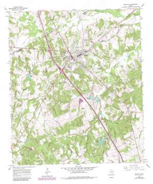
Buffalo Topo Map Texas
To zoom in, hover over the map of Buffalo
USGS Topo Quad 31096d1 - 1:24,000 scale
| Topo Map Name: | Buffalo |
| USGS Topo Quad ID: | 31096d1 |
| Print Size: | ca. 21 1/4" wide x 27" high |
| Southeast Coordinates: | 31.375° N latitude / 96° W longitude |
| Map Center Coordinates: | 31.4375° N latitude / 96.0625° W longitude |
| U.S. State: | TX |
| Filename: | o31096d1.jpg |
| Download Map JPG Image: | Buffalo topo map 1:24,000 scale |
| Map Type: | Topographic |
| Topo Series: | 7.5´ |
| Map Scale: | 1:24,000 |
| Source of Map Images: | United States Geological Survey (USGS) |
| Alternate Map Versions: |
Buffalo TX 1965, updated 1967 Download PDF Buy paper map Buffalo TX 1965, updated 1983 Download PDF Buy paper map Buffalo TX 2010 Download PDF Buy paper map Buffalo TX 2013 Download PDF Buy paper map Buffalo TX 2016 Download PDF Buy paper map |
1:24,000 Topo Quads surrounding Buffalo
> Back to 31096a1 at 1:100,000 scale
> Back to 31096a1 at 1:250,000 scale
> Back to U.S. Topo Maps home
Buffalo topo map: Gazetteer
Buffalo: Dams
Cain Lake Dam elevation 101m 331′Harcrow Dam Number 1 elevation 99m 324′
Harcrow Lake Number 2 Dam elevation 96m 314′
Heil Lake Dam elevation 103m 337′
Raines Dam elevation 107m 351′
Whitaker Dam elevation 112m 367′
Buffalo: Lakes
Days Lake elevation 114m 374′Harcrow Lake elevation 99m 324′
Buffalo: Populated Places
Buffalo elevation 117m 383′Buffalo: Reservoirs
Cain Lake elevation 101m 331′Days Lake elevation 112m 367′
Harcrow Lake Number 1 elevation 99m 324′
Harcrow Lake Number 2 elevation 96m 314′
Heil Lake elevation 103m 337′
Red Oak Lake elevation 110m 360′
Buffalo: Streams
Alligator Creek elevation 88m 288′Bow Branch elevation 91m 298′
Browns Creek elevation 79m 259′
Cane Branch elevation 82m 269′
Cedar Creek elevation 91m 298′
Copper Creek elevation 86m 282′
Haw Branch elevation 92m 301′
Red Oak Branch elevation 101m 331′
Rena Branch elevation 91m 298′
Right Branch elevation 97m 318′
Smith Branch elevation 95m 311′
Whitney Branch elevation 88m 288′
Buffalo digital topo map on disk
Buy this Buffalo topo map showing relief, roads, GPS coordinates and other geographical features, as a high-resolution digital map file on DVD:


