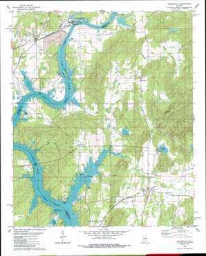
Wilsonville Topo Map Alabama
To zoom in, hover over the map of Wilsonville
USGS Topo Quad 33086b4 - 1:24,000 scale
| Topo Map Name: | Wilsonville |
| USGS Topo Quad ID: | 33086b4 |
| Print Size: | ca. 21 1/4" wide x 27" high |
| Southeast Coordinates: | 33.125° N latitude / 86.375° W longitude |
| Map Center Coordinates: | 33.1875° N latitude / 86.4375° W longitude |
| U.S. State: | AL |
| Filename: | o33086b4.jpg |
| Download Map JPG Image: | Wilsonville topo map 1:24,000 scale |
| Map Type: | Topographic |
| Topo Series: | 7.5´ |
| Map Scale: | 1:24,000 |
| Source of Map Images: | United States Geological Survey (USGS) |
| Alternate Map Versions: |
Gantts Quarry NW AL 1975, updated 1977 Download PDF Buy paper map Wilsonville AL 1980, updated 1980 Download PDF Buy paper map Wilsonville AL 1980, updated 1986 Download PDF Buy paper map Wilsonville AL 2011 Download PDF Buy paper map Wilsonville AL 2014 Download PDF Buy paper map |
1:24,000 Topo Quads surrounding Wilsonville
> Back to 33086a1 at 1:100,000 scale
> Back to 33086a1 at 1:250,000 scale
> Back to U.S. Topo Maps home
Wilsonville topo map: Gazetteer
Wilsonville: Bars
Fort Williams Shoals (historical) elevation 119m 390′Three Island Shoals (historical) elevation 119m 390′
Wilsonville: Bays
Paradise Cove elevation 119m 390′Wilsonville: Crossings
Fort Williams Ferry (historical) elevation 119m 390′McGowans Ferry (historical) elevation 123m 403′
Owens Ferry (historical) elevation 119m 390′
Perkins Ferry elevation 119m 390′
Wilsonville: Dams
Caudle Dam elevation 154m 505′Cleitts Dam elevation 154m 505′
Goodner Dam elevation 136m 446′
Wilsonville: Islands
Bullocks Islands elevation 122m 400′Steamboat Island (historical) elevation 119m 390′
Wilsonville: Parks
Helms Park elevation 156m 511′Wilsonville: Populated Places
Carleton Point elevation 134m 439′Deans elevation 142m 465′
Fayetteville elevation 133m 436′
Homestead elevation 128m 419′
Indian Shoals elevation 124m 406′
Kahatchee elevation 151m 495′
Kowakas Mobile Home Park elevation 152m 498′
Mount Sharon elevation 147m 482′
Paradise Point Estates elevation 126m 413′
Shelby Shores elevation 130m 426′
Valentine elevation 128m 419′
Wilsonville elevation 129m 423′
Wilsonville: Post Offices
Wilsonville Post Office elevation 137m 449′Wilsonville: Reservoirs
Caudles Lake elevation 136m 446′Cleitts Lake elevation 154m 505′
Goodner Lake elevation 136m 446′
Wilsonville: Ridges
Katala Hills elevation 256m 839′Wilsonville: Springs
Chalybeate Spring elevation 128m 419′Deans Spring elevation 141m 462′
Wilsonville: Streams
Averett Branch elevation 128m 419′Cedar Creek elevation 119m 390′
Cohabie Creek elevation 123m 403′
Dry Branch elevation 119m 390′
Flat Branch elevation 119m 390′
Hay Spring Branch elevation 122m 400′
Kahatchee Creek elevation 119m 390′
Kelley Branch elevation 120m 393′
Lower Mud Creek elevation 122m 400′
Mud Branch elevation 120m 393′
Periwinkle Branch elevation 124m 406′
Pope Branch elevation 122m 400′
Waters Branch elevation 124m 406′
Yellowleaf Creek elevation 119m 390′
Wilsonville: Summits
Cohabie Mountain elevation 300m 984′Wilsonville digital topo map on disk
Buy this Wilsonville topo map showing relief, roads, GPS coordinates and other geographical features, as a high-resolution digital map file on DVD:


