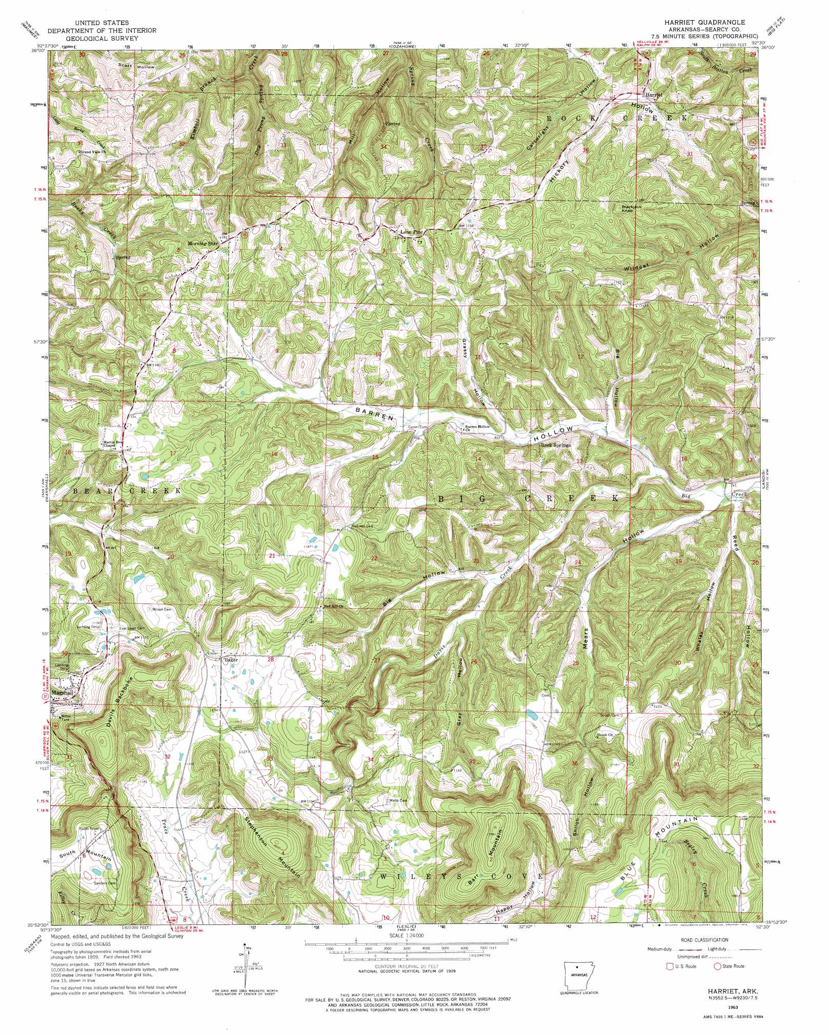
Harriet Topo Map Arkansas
To zoom in, hover over the map of Harriet
USGS Topo Quad 35092h5 - 1:24,000 scale
| Topo Map Name: | Harriet |
| USGS Topo Quad ID: | 35092h5 |
| Print Size: | ca. 21 1/4" wide x 27" high |
| Southeast Coordinates: | 35.875° N latitude / 92.5° W longitude |
| Map Center Coordinates: | 35.9375° N latitude / 92.5625° W longitude |
| U.S. State: | AR |
| Filename: | o35092h5.jpg |
| Download Map JPG Image: | Harriet topo map 1:24,000 scale |
| Map Type: | Topographic |
| Topo Series: | 7.5´ |
| Map Scale: | 1:24,000 |
| Source of Map Images: | United States Geological Survey (USGS) |
| Alternate Map Versions: |
Harriet AR 1963, updated 1964 Download PDF Buy paper map Harriet AR 1963, updated 1975 Download PDF Buy paper map Harriet AR 2011 Download PDF Buy paper map Harriet AR 2014 Download PDF Buy paper map |
1:24,000 Topo Quads surrounding Harriet
Bruno |
Yellville |
Rea Valley |
Buffalo City |
Norfork |
Saint Joe |
Maumee |
Cozahome |
Big Flat |
Norfork Se |
Snowball |
Marshall |
Harriet |
Landis |
Onia |
Witts Spring |
Canaan |
Leslie |
Oxley |
Fox |
Tilly |
Alread |
Botkinburg |
Old Lexington |
Shirley |
> Back to 35092e1 at 1:100,000 scale
> Back to 35092a1 at 1:250,000 scale
> Back to U.S. Topo Maps home
Harriet topo map: Gazetteer
Harriet: Areas
The Wilderness elevation 335m 1099′Harriet: Populated Places
Baker elevation 368m 1207′Barren Hollow elevation 277m 908′
Begley (historical) elevation 369m 1210′
Harriet elevation 272m 892′
Lone Pine elevation 364m 1194′
Martin Box elevation 347m 1138′
Morning Star elevation 357m 1171′
Rock Springs elevation 248m 813′
Shilo (historical) elevation 342m 1122′
Harriet: Post Offices
Harriet Post Office elevation 272m 892′Harriet: Ridges
Devils Backbone elevation 438m 1437′Harriet: Streams
Davis Creek elevation 223m 731′Kimball Branch elevation 198m 649′
Harriet: Summits
Barr Mountain elevation 530m 1738′Blackjack Knob elevation 373m 1223′
Stephenson Mountain elevation 488m 1601′
Harriet: Valleys
Barren Hollow elevation 221m 725′Big Hollow elevation 242m 793′
Big Hollow elevation 231m 757′
Cartwright Hollow elevation 259m 849′
Grassy Hollow elevation 249m 816′
Gray Hollow elevation 248m 813′
Mears Hollow elevation 217m 711′
Mill Hollow elevation 217m 711′
Reed Hollow elevation 210m 688′
Shiloh Hollow elevation 285m 935′
Whaley Hollow elevation 222m 728′
Harriet digital topo map on disk
Buy this Harriet topo map showing relief, roads, GPS coordinates and other geographical features, as a high-resolution digital map file on DVD: