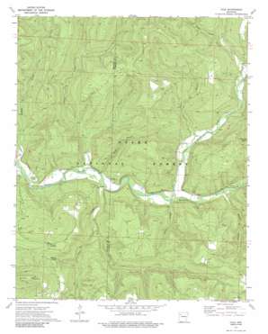
Yale Topo Map Arkansas
To zoom in, hover over the map of Yale
USGS Topo Quad 35093f6 - 1:24,000 scale
| Topo Map Name: | Yale |
| USGS Topo Quad ID: | 35093f6 |
| Print Size: | ca. 21 1/4" wide x 27" high |
| Southeast Coordinates: | 35.625° N latitude / 93.625° W longitude |
| Map Center Coordinates: | 35.6875° N latitude / 93.6875° W longitude |
| U.S. State: | AR |
| Filename: | o35093f6.jpg |
| Download Map JPG Image: | Yale topo map 1:24,000 scale |
| Map Type: | Topographic |
| Topo Series: | 7.5´ |
| Map Scale: | 1:24,000 |
| Source of Map Images: | United States Geological Survey (USGS) |
| Alternate Map Versions: |
Yale AR 1973, updated 1976 Download PDF Buy paper map Yale AR 1973, updated 1986 Download PDF Buy paper map Yale AR 2011 Download PDF Buy paper map Yale AR 2014 Download PDF Buy paper map |
| FStopo: | US Forest Service topo Yale is available: Download FStopo PDF Download FStopo TIF |
1:24,000 Topo Quads surrounding Yale
Durham |
Japton |
Witter |
Weathers |
Boxley |
Delaney |
Saint Paul |
Pettigrew |
Boston |
Fallsville |
Bidville |
Cass |
Yale |
Oark |
Ozone |
Cravens |
Watalula |
Hunt |
Harmony |
Ludwig |
Cecil |
Ozark |
Coal Hill |
Hartman |
Clarksville |
> Back to 35093e1 at 1:100,000 scale
> Back to 35092a1 at 1:250,000 scale
> Back to U.S. Topo Maps home
Yale topo map: Gazetteer
Yale: Populated Places
Beach Grove elevation 242m 793′Friley elevation 305m 1000′
Mineral Springs elevation 433m 1420′
Peanut elevation 262m 859′
Pittston Junction elevation 487m 1597′
Yale elevation 281m 921′
Yale: Streams
Briar Branch elevation 253m 830′Clear Creek elevation 248m 813′
Clear Creek elevation 275m 902′
Friley Creek elevation 309m 1013′
Herrods Creek elevation 232m 761′
Indian Creek elevation 246m 807′
Lick Branch elevation 275m 902′
Little Mulberry Creek elevation 262m 859′
Pea Prong Creek elevation 321m 1053′
Shop Branch elevation 262m 859′
Yale: Summits
Brushy Mountain elevation 628m 2060′Yale: Valleys
Butts Hollow elevation 264m 866′Sarah Hollow elevation 279m 915′
Yale digital topo map on disk
Buy this Yale topo map showing relief, roads, GPS coordinates and other geographical features, as a high-resolution digital map file on DVD:


