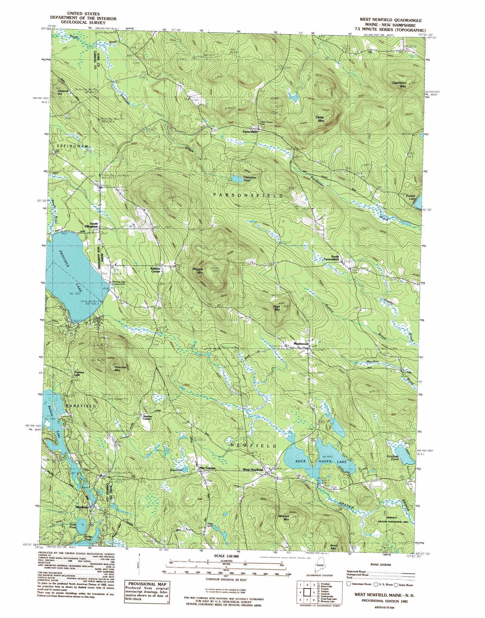
West Newfield Topo Map Maine
To zoom in, hover over the map of West Newfield
USGS Topo Quad 43070f8 - 1:24,000 scale
| Topo Map Name: | West Newfield |
| USGS Topo Quad ID: | 43070f8 |
| Print Size: | ca. 21 1/4" wide x 27" high |
| Southeast Coordinates: | 43.625° N latitude / 70.875° W longitude |
| Map Center Coordinates: | 43.6875° N latitude / 70.9375° W longitude |
| U.S. States: | ME, NH |
| Filename: | o43070f8.jpg |
| Download Map JPG Image: | West Newfield topo map 1:24,000 scale |
| Map Type: | Topographic |
| Topo Series: | 7.5´ |
| Map Scale: | 1:24,000 |
| Source of Map Images: | United States Geological Survey (USGS) |
| Alternate Map Versions: |
West Newfield ME 1983, updated 1983 Download PDF Buy paper map West Newfield ME 1983, updated 1983 Download PDF Buy paper map West Newfield ME 2011 Download PDF Buy paper map West Newfield ME 2014 Download PDF Buy paper map |
1:24,000 Topo Quads surrounding West Newfield
Silver Lake |
Conway |
Brownfield |
Hiram |
North Sebago |
Ossipee Lake |
Freedom |
Kezar Falls |
Cornish |
Steep Falls |
Tuftonboro |
Ossipee |
West Newfield |
Limerick |
Limington |
Wolfeboro |
Sanbornville |
Great East Lake |
Mousam Lake |
Waterboro |
Alton |
Farmington |
Milton |
Sanford |
Alfred |
> Back to 43070e1 at 1:100,000 scale
> Back to 43070a1 at 1:250,000 scale
> Back to U.S. Topo Maps home
West Newfield topo map: Gazetteer
West Newfield: Beaches
Providence Lake Beach elevation 146m 479′West Newfield: Dams
Belleau Lake Dam elevation 178m 583′Rock Haven Lake Dam elevation 134m 439′
Woodman Dam elevation 177m 580′
West Newfield: Lakes
Champion Pond elevation 199m 652′Drew Pond elevation 176m 577′
Province Lake elevation 146m 479′
Province Lake elevation 146m 479′
Sand Pond elevation 170m 557′
West Newfield: Populated Places
Maplewood elevation 183m 600′Mee Corners elevation 191m 626′
Parsonsfield elevation 220m 721′
Roberts Corner elevation 202m 662′
South Effingham elevation 165m 541′
South Effingham elevation 161m 528′
South Parsonsfield elevation 171m 561′
Stevens Corner elevation 223m 731′
West Newfield elevation 157m 515′
Woodman elevation 177m 580′
West Newfield: Reservoirs
Belleau Lake elevation 172m 564′Little Ossipee River Reservoir elevation 177m 580′
Rock Haven Lake elevation 134m 439′
West Newfield: Streams
Emerson Brook elevation 124m 406′Hobbs Brook elevation 125m 410′
West Newfield: Summits
Cedar Mountain elevation 338m 1108′Colcord Hill elevation 234m 767′
Dearborn Mountain elevation 333m 1092′
Mitchell Mountain elevation 295m 967′
Page Mountain elevation 284m 931′
Province Mountain elevation 348m 1141′
Province Mountain elevation 332m 1089′
Wiggin Mountain elevation 394m 1292′
West Newfield digital topo map on disk
Buy this West Newfield topo map showing relief, roads, GPS coordinates and other geographical features, as a high-resolution digital map file on DVD:
Maine, New Hampshire, Rhode Island & Eastern Massachusetts
Buy digital topo maps: Maine, New Hampshire, Rhode Island & Eastern Massachusetts