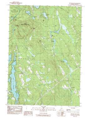
Mousam Lake Topo Map Maine
To zoom in, hover over the map of Mousam Lake
USGS Topo Quad 43070e7 - 1:24,000 scale
| Topo Map Name: | Mousam Lake |
| USGS Topo Quad ID: | 43070e7 |
| Print Size: | ca. 21 1/4" wide x 27" high |
| Southeast Coordinates: | 43.5° N latitude / 70.75° W longitude |
| Map Center Coordinates: | 43.5625° N latitude / 70.8125° W longitude |
| U.S. State: | ME |
| Filename: | o43070e7.jpg |
| Download Map JPG Image: | Mousam Lake topo map 1:24,000 scale |
| Map Type: | Topographic |
| Topo Series: | 7.5´ |
| Map Scale: | 1:24,000 |
| Source of Map Images: | United States Geological Survey (USGS) |
| Alternate Map Versions: |
Mousam Lake ME 1983, updated 1983 Download PDF Buy paper map Mousam Lake ME 2011 Download PDF Buy paper map Mousam Lake ME 2014 Download PDF Buy paper map |
1:24,000 Topo Quads surrounding Mousam Lake
> Back to 43070e1 at 1:100,000 scale
> Back to 43070a1 at 1:250,000 scale
> Back to U.S. Topo Maps home
Mousam Lake topo map: Gazetteer
Mousam Lake: Dams
Pine Springs Lake Dam elevation 124m 406′Square Pond Outlet Dam elevation 171m 561′
Mousam Lake: Lakes
Goose Pond elevation 146m 479′Granny Kent Pond elevation 138m 452′
Little Poverty Pond elevation 130m 426′
Mann Pond elevation 130m 426′
Middle Branch Pond elevation 130m 426′
Northwest Pond elevation 130m 426′
Round Pond elevation 140m 459′
Shy Beaver Pond elevation 125m 410′
Spicer Pond elevation 140m 459′
Mousam Lake: Parks
Newfield Wildlife Management Area elevation 156m 511′Mousam Lake: Populated Places
North Alfred elevation 116m 380′Ross Corner elevation 137m 449′
Shapleigh elevation 178m 583′
Mousam Lake: Reservoirs
Pine Springs Lake elevation 124m 406′Square Pond elevation 171m 561′
Mousam Lake: Ridges
Fort Ridge elevation 262m 859′Mousam Lake: Streams
Conant Brook elevation 134m 439′Davis Brook elevation 132m 433′
Henderson Brook elevation 118m 387′
Jones Brook elevation 143m 469′
Norton Brook elevation 170m 557′
Pump Box Brook elevation 146m 479′
Mousam Lake: Summits
Abbott Mountain elevation 324m 1062′Hussey Mountain elevation 274m 898′
Mann Mountain elevation 206m 675′
Ross Mountain elevation 184m 603′
Sugarloaf Mountain elevation 257m 843′
Zekes Mountain elevation 200m 656′
Mousam Lake digital topo map on disk
Buy this Mousam Lake topo map showing relief, roads, GPS coordinates and other geographical features, as a high-resolution digital map file on DVD:
Maine, New Hampshire, Rhode Island & Eastern Massachusetts
Buy digital topo maps: Maine, New Hampshire, Rhode Island & Eastern Massachusetts


