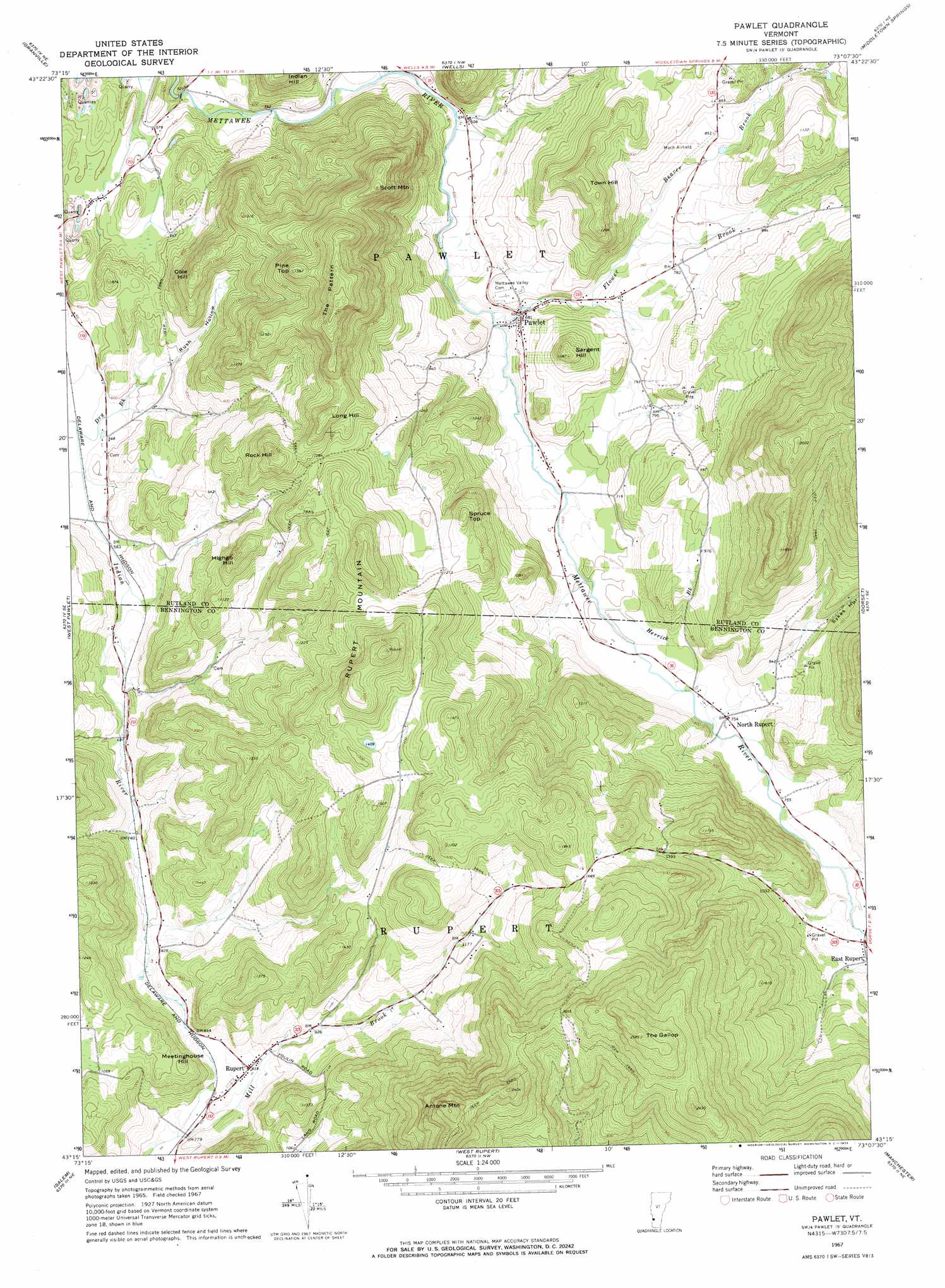
Pawlet Topo Map Vermont
To zoom in, hover over the map of Pawlet
USGS Topo Quad 43073c2 - 1:24,000 scale
| Topo Map Name: | Pawlet |
| USGS Topo Quad ID: | 43073c2 |
| Print Size: | ca. 21 1/4" wide x 27" high |
| Southeast Coordinates: | 43.25° N latitude / 73.125° W longitude |
| Map Center Coordinates: | 43.3125° N latitude / 73.1875° W longitude |
| U.S. State: | VT |
| Filename: | o43073c2.jpg |
| Download Map JPG Image: | Pawlet topo map 1:24,000 scale |
| Map Type: | Topographic |
| Topo Series: | 7.5´ |
| Map Scale: | 1:24,000 |
| Source of Map Images: | United States Geological Survey (USGS) |
| Alternate Map Versions: |
Pawlet VT 1967, updated 1972 Download PDF Buy paper map Pawlet VT 1995, updated 2000 Download PDF Buy paper map Pawlet VT 2012 Download PDF Buy paper map Pawlet VT 2015 Download PDF Buy paper map |
| FStopo: | US Forest Service topo Pawlet is available: Download FStopo PDF Download FStopo TIF |
1:24,000 Topo Quads surrounding Pawlet
Whitehall |
Thorn Hill |
Poultney |
West Rutland |
Rutland |
Fort Ann |
Granville |
Wells |
Middletown Springs |
Wallingford |
Hartford |
West Pawlet |
Pawlet |
Dorset |
Danby |
Cossayuna |
Salem |
West Rupert |
Manchester |
Peru |
Cambridge |
Shushan |
Arlington |
Sunderland |
Stratton Mountain |
> Back to 43073a1 at 1:100,000 scale
> Back to 43072a1 at 1:250,000 scale
> Back to U.S. Topo Maps home
Pawlet topo map: Gazetteer
Pawlet: Airports
Mach Personal Strip elevation 258m 846′Pawlet: Forests
Rupert Town Forest elevation 347m 1138′Pawlet: Populated Places
East Rupert elevation 252m 826′North Rupert elevation 230m 754′
Pawlet elevation 215m 705′
Rupert elevation 254m 833′
Pawlet: Post Offices
Pawlet Post Office elevation 206m 675′Rupert Post Office elevation 253m 830′
Pawlet: Streams
Beaver Brook elevation 224m 734′Dry Brook elevation 167m 547′
Flower Brook elevation 192m 629′
Herrick Brook elevation 210m 688′
Pawlet: Summits
Antone Mountain elevation 792m 2598′Cole Hill elevation 360m 1181′
Highgo Hill elevation 397m 1302′
Long Hill elevation 470m 1541′
Meetinghouse Hill elevation 342m 1122′
Pine Top elevation 476m 1561′
Rock Hill elevation 440m 1443′
Rupert Mountain elevation 562m 1843′
Sargent Hill elevation 326m 1069′
Scott Mountain elevation 474m 1555′
Spruce Top elevation 404m 1325′
The Gallop elevation 783m 2568′
The Pattern elevation 557m 1827′
Town Hill elevation 387m 1269′
Pawlet: Valleys
Rush Hollow elevation 191m 626′Sykes Hollow elevation 284m 931′
Pawlet digital topo map on disk
Buy this Pawlet topo map showing relief, roads, GPS coordinates and other geographical features, as a high-resolution digital map file on DVD:
New York, Vermont, Connecticut & Western Massachusetts
Buy digital topo maps: New York, Vermont, Connecticut & Western Massachusetts