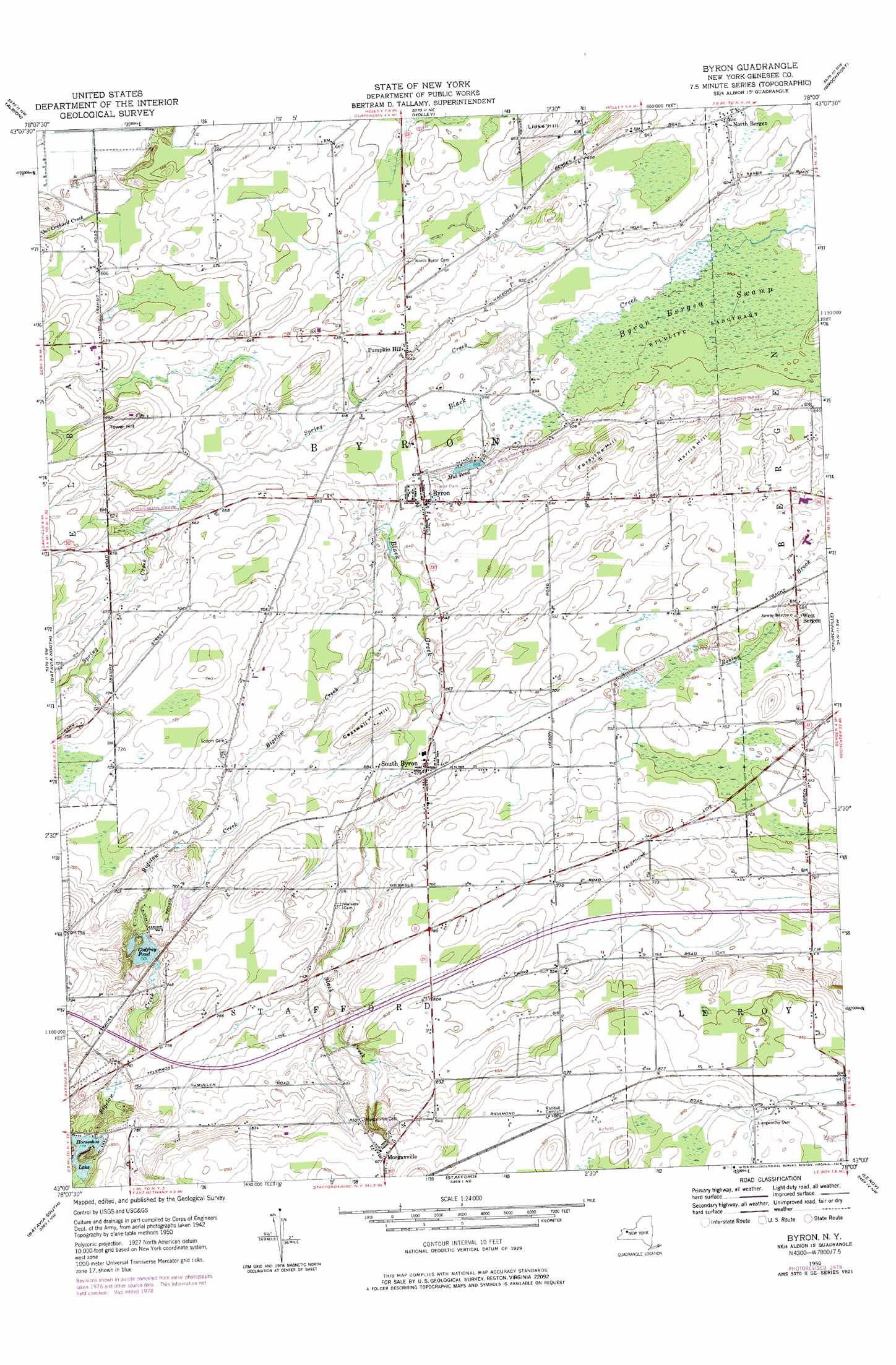
Byron Topo Map New York
To zoom in, hover over the map of Byron
USGS Topo Quad 43078a1 - 1:24,000 scale
| Topo Map Name: | Byron |
| USGS Topo Quad ID: | 43078a1 |
| Print Size: | ca. 21 1/4" wide x 27" high |
| Southeast Coordinates: | 43° N latitude / 78° W longitude |
| Map Center Coordinates: | 43.0625° N latitude / 78.0625° W longitude |
| U.S. State: | NY |
| Filename: | o43078a1.jpg |
| Download Map JPG Image: | Byron topo map 1:24,000 scale |
| Map Type: | Topographic |
| Topo Series: | 7.5´ |
| Map Scale: | 1:24,000 |
| Source of Map Images: | United States Geological Survey (USGS) |
| Alternate Map Versions: |
Byron NY 1950, updated 1969 Download PDF Buy paper map Byron NY 1950, updated 1978 Download PDF Buy paper map Byron NY 1950, updated 1978 Download PDF Buy paper map Byron NY 1952 Download PDF Buy paper map Byron NY 2010 Download PDF Buy paper map Byron NY 2013 Download PDF Buy paper map Byron NY 2016 Download PDF Buy paper map |
1:24,000 Topo Quads surrounding Byron
Ashwood |
Kent |
Kendall |
Hamlin |
Hilton |
Knowlesville |
Albion |
Holley |
Brockport |
Spencerport |
Oakfield |
Batavia North |
Byron |
Churchville |
Clifton |
Alexander |
Batavia South |
Stafford |
Le Roy |
Caledonia |
Attica |
Dale |
Wyoming |
Leicester |
Geneseo |
> Back to 43078a1 at 1:100,000 scale
> Back to 43078a1 at 1:250,000 scale
> Back to U.S. Topo Maps home
Byron topo map: Gazetteer
Byron: Lakes
Godfrey Pond elevation 221m 725′Byron: Populated Places
Byron elevation 189m 620′Morganville elevation 266m 872′
North Bergen elevation 189m 620′
Pumpkin Hill elevation 196m 643′
South Byron elevation 206m 675′
West Bergen elevation 208m 682′
Byron: Reservoirs
Horseshoe Lake elevation 237m 777′Mill Pond elevation 183m 600′
Byron: Streams
Bigelow Creek elevation 189m 620′Spring Creek elevation 180m 590′
Byron: Summits
Casswell Hill elevation 223m 731′Forsythe Hill elevation 214m 702′
Harris Hill elevation 209m 685′
Lidke Hill elevation 214m 702′
Tower Hill elevation 220m 721′
Byron: Swamps
Byron-Bergen Swamp elevation 178m 583′Byron digital topo map on disk
Buy this Byron topo map showing relief, roads, GPS coordinates and other geographical features, as a high-resolution digital map file on DVD:
 map DVD")