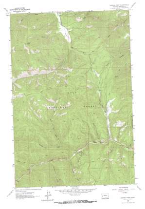
Garden Point Topo Map Montana
To zoom in, hover over the map of Garden Point
USGS Topo Quad 46114g4 - 1:24,000 scale
| Topo Map Name: | Garden Point |
| USGS Topo Quad ID: | 46114g4 |
| Print Size: | ca. 21 1/4" wide x 27" high |
| Southeast Coordinates: | 46.75° N latitude / 114.375° W longitude |
| Map Center Coordinates: | 46.8125° N latitude / 114.4375° W longitude |
| U.S. State: | MT |
| Filename: | o46114g4.jpg |
| Download Map JPG Image: | Garden Point topo map 1:24,000 scale |
| Map Type: | Topographic |
| Topo Series: | 7.5´ |
| Map Scale: | 1:24,000 |
| Source of Map Images: | United States Geological Survey (USGS) |
| Alternate Map Versions: |
Garden Point MT 1964, updated 1967 Download PDF Buy paper map Garden Point MT 1999, updated 2003 Download PDF Buy paper map Garden Point MT 2011 Download PDF Buy paper map Garden Point MT 2014 Download PDF Buy paper map |
| FStopo: | US Forest Service topo Garden Point is available: Download FStopo PDF Download FStopo TIF |
1:24,000 Topo Quads surrounding Garden Point
> Back to 46114e1 at 1:100,000 scale
> Back to 46114a1 at 1:250,000 scale
> Back to U.S. Topo Maps home
Garden Point topo map: Gazetteer
Garden Point: Cliffs
Garden Point elevation 1757m 5764′Garden Point: Flats
Grave Creek Meadow elevation 1194m 3917′Garden Point: Streams
Bill Creek elevation 1151m 3776′Cedar Run Creek elevation 1253m 4110′
Clark Creek elevation 1141m 3743′
Cloudburst Creek elevation 1200m 3937′
Davis Creek elevation 1147m 3763′
East Fork Grave Creek elevation 1187m 3894′
East Fork Petty Creek elevation 1194m 3917′
Garden Creek elevation 1143m 3750′
Grave Creek elevation 1152m 3779′
Howard Creek elevation 1169m 3835′
Hungry Creek elevation 1166m 3825′
Mike Creek elevation 1167m 3828′
Moulton Reservoir Number Two elevation 1125m 3690′
North Fork Howard Creek elevation 1205m 3953′
South Fork Petty Creek elevation 1186m 3891′
Garden Point: Valleys
Chief Joseph Gulch elevation 1197m 3927′Cooley Gulch elevation 1143m 3750′
Garden Point digital topo map on disk
Buy this Garden Point topo map showing relief, roads, GPS coordinates and other geographical features, as a high-resolution digital map file on DVD:


