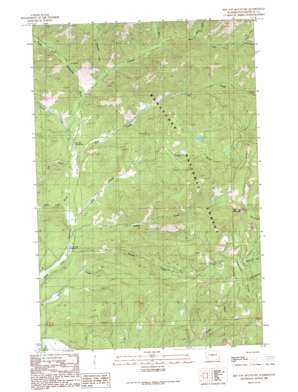
Red Top Mountain Topo Map Washington
To zoom in, hover over the map of Red Top Mountain
USGS Topo Quad 47120c7 - 1:24,000 scale
| Topo Map Name: | Red Top Mountain |
| USGS Topo Quad ID: | 47120c7 |
| Print Size: | ca. 21 1/4" wide x 27" high |
| Southeast Coordinates: | 47.25° N latitude / 120.75° W longitude |
| Map Center Coordinates: | 47.3125° N latitude / 120.8125° W longitude |
| U.S. State: | WA |
| Filename: | o47120c7.jpg |
| Download Map JPG Image: | Red Top Mountain topo map 1:24,000 scale |
| Map Type: | Topographic |
| Topo Series: | 7.5´ |
| Map Scale: | 1:24,000 |
| Source of Map Images: | United States Geological Survey (USGS) |
| Alternate Map Versions: |
Red Top Mountain WA 1989, updated 1989 Download PDF Buy paper map Red Top Mountain WA 2003, updated 2006 Download PDF Buy paper map Red Top Mountain WA 2011 Download PDF Buy paper map Red Top Mountain WA 2014 Download PDF Buy paper map |
| FStopo: | US Forest Service topo Red Top Mountain is available: Download FStopo PDF Download FStopo TIF |
1:24,000 Topo Quads surrounding Red Top Mountain
> Back to 47120a1 at 1:100,000 scale
> Back to 47120a1 at 1:250,000 scale
> Back to U.S. Topo Maps home
Red Top Mountain topo map: Gazetteer
Red Top Mountain: Ridges
Teanaway Ridge elevation 1540m 5052′Red Top Mountain: Streams
Bear Creek elevation 933m 3061′Dickey Creek elevation 729m 2391′
Indian Creek elevation 744m 2440′
Jack Creek elevation 775m 2542′
Jungle Creek elevation 796m 2611′
Middle Creek elevation 735m 2411′
Miller Creek elevation 991m 3251′
North Fork Bear Creek elevation 1063m 3487′
Rye Creek elevation 774m 2539′
Shirk Creek elevation 748m 2454′
South Fork Bear Creek elevation 1096m 3595′
Stafford Creek elevation 844m 2769′
Standup Creek elevation 862m 2828′
Story Creek elevation 684m 2244′
Red Top Mountain: Summits
Red Top Mountain elevation 1570m 5150′Red Top Mountain: Trails
Dickey Creek Trail elevation 1269m 4163′Red Top Mountain digital topo map on disk
Buy this Red Top Mountain topo map showing relief, roads, GPS coordinates and other geographical features, as a high-resolution digital map file on DVD:


