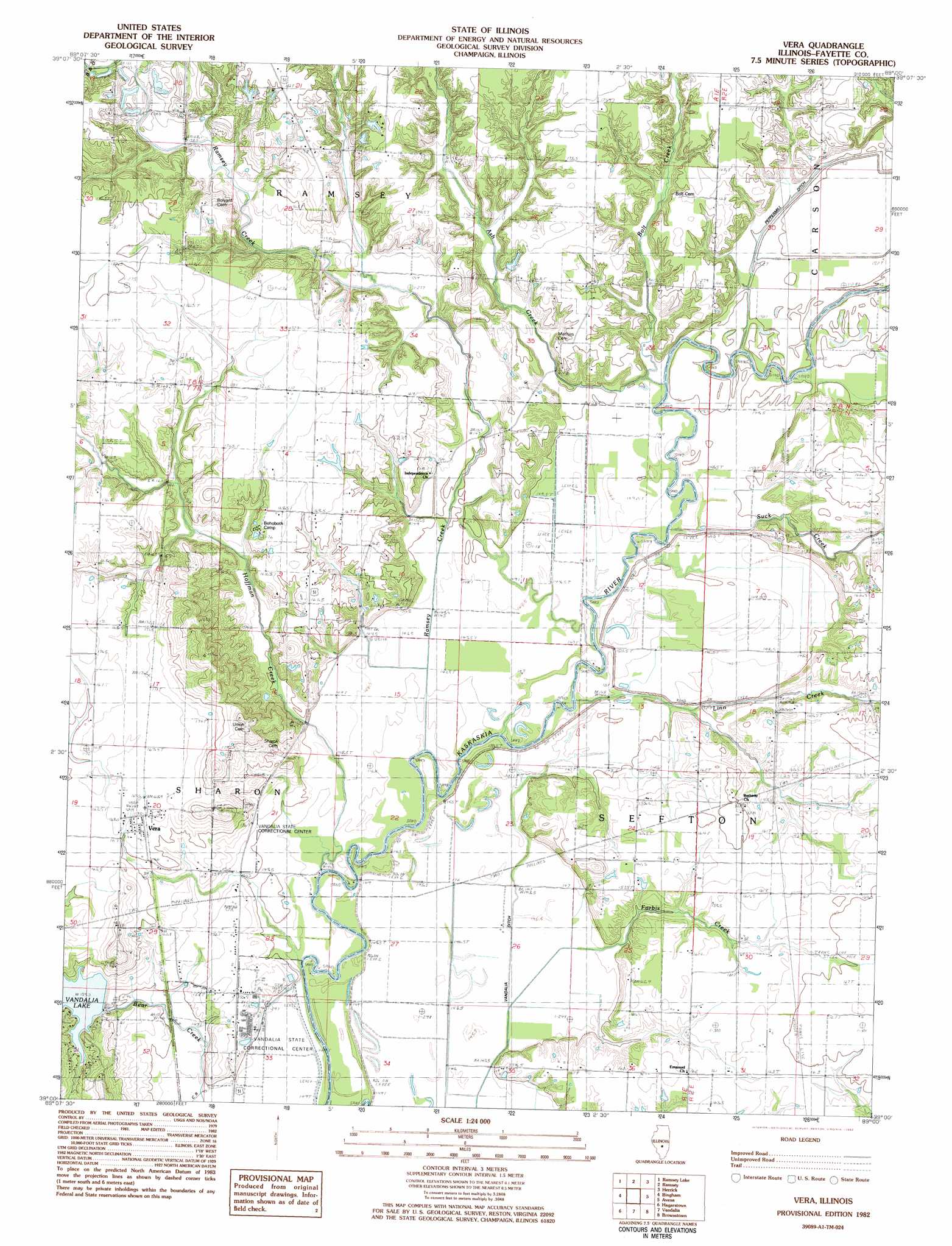
Vera Topo Map Illinois
To zoom in, hover over the map of Vera
USGS Topo Quad 39089a1 - 1:24,000 scale
| Topo Map Name: | Vera |
| USGS Topo Quad ID: | 39089a1 |
| Print Size: | ca. 21 1/4" wide x 27" high |
| Southeast Coordinates: | 39° N latitude / 89° W longitude |
| Map Center Coordinates: | 39.0625° N latitude / 89.0625° W longitude |
| U.S. State: | IL |
| Filename: | o39089a1.jpg |
| Download Map JPG Image: | Vera topo map 1:24,000 scale |
| Map Type: | Topographic |
| Topo Series: | 7.5´ |
| Map Scale: | 1:24,000 |
| Source of Map Images: | United States Geological Survey (USGS) |
| Alternate Map Versions: |
Vera IL 1982, updated 1982 Download PDF Buy paper map Vera IL 1998, updated 2002 Download PDF Buy paper map Vera IL 2012 Download PDF Buy paper map Vera IL 2015 Download PDF Buy paper map |
1:24,000 Topo Quads surrounding Vera
Nokomis |
Ohlman |
Oconee |
Lakewood |
Fancher |
Bald Knob |
Ramsey Lake |
Ramsey |
Herrick |
Beecher City |
Fillmore |
Bingham |
Vera |
Avena |
Altamont West |
Mulberry Grove |
Hagarstown |
Vandalia |
Brownstown |
Loogootee |
Pleasant Mound |
Wildcat Lake |
Patoka |
Saint Paul |
Kinmundy |
> Back to 39089a1 at 1:100,000 scale
> Back to 39088a1 at 1:250,000 scale
> Back to U.S. Topo Maps home
Vera topo map: Gazetteer
Vera: Canals
Peppermill Ditch elevation 150m 492′Vera: Dams
Vandalia Municipal Reservoir Dam elevation 152m 498′Vera: Populated Places
Vera elevation 170m 557′Vera: Reservoirs
Vandalia Municipal Reservoir elevation 152m 498′Vera: Streams
Ash Creek elevation 147m 482′Bolt Creek elevation 150m 492′
Forbis Creek elevation 145m 475′
Hoffman Creek elevation 144m 472′
Linn Creek elevation 144m 472′
Ramsey Creek elevation 144m 472′
Suck Creek elevation 145m 475′
Vera digital topo map on disk
Buy this Vera topo map showing relief, roads, GPS coordinates and other geographical features, as a high-resolution digital map file on DVD:
Northern Illinois, Northern Indiana & Southwestern Michigan
Buy digital topo maps: Northern Illinois, Northern Indiana & Southwestern Michigan