Pea Ridge Topo Map North Carolina
To zoom in, hover over the map of Pea Ridge
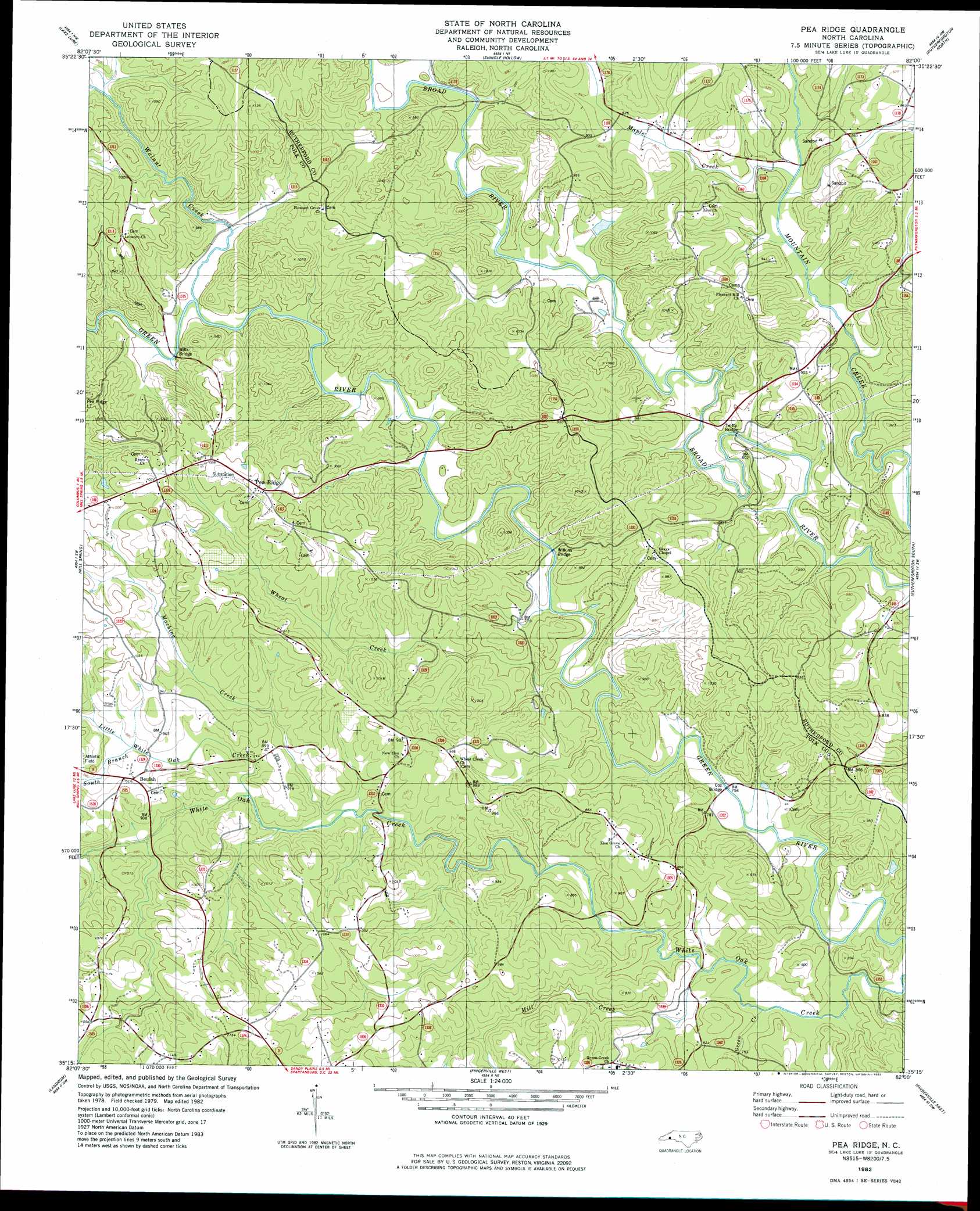
USGS Topo Quad 35082c1 - 1:24,000 scale
| Topo Map Name: | Pea Ridge |
| USGS Topo Quad ID: | 35082c1 |
| Print Size: | ca. 21 1/4" wide x 27" high |
| Southeast Coordinates: | 35.25° N latitude / 82° W longitude |
| Map Center Coordinates: | 35.3125° N latitude / 82.0625° W longitude |
| U.S. State: | NC |
| Filename: | o35082c1.jpg |
| Download Map JPG Image: | Pea Ridge topo map 1:24,000 scale |
| Map Type: | Topographic |
| Topo Series: | 7.5´ |
| Map Scale: | 1:24,000 |
| Source of Map Images: | United States Geological Survey (USGS) |
| Alternate Map Versions: |
Pea Ridge NC 1982, updated 1983 Download PDF Buy paper map Pea Ridge NC 2010 Download PDF Buy paper map Pea Ridge NC 2013 Download PDF Buy paper map Pea Ridge NC 2016 Download PDF Buy paper map |
1:24,000 Topo Quads surrounding Pea Ridge
Black Mountain |
Moffitt Hill |
Sugar Hill |
Glenwood |
Dysartsville |
Bat Cave |
Lake Lure |
Shingle Hollow |
Rutherfordton North |
Sunshine |
Cliffield Mountain |
Mill Spring |
Pea Ridge |
Rutherfordton South |
Forest City |
Saluda |
Landrum |
Fingerville West |
Fingerville East |
Chesnee |
Tigerville |
Campobello |
Inman |
Valley Falls |
Cowpens |
> Back to 35082a1 at 1:100,000 scale
> Back to 35082a1 at 1:250,000 scale
> Back to U.S. Topo Maps home
Pea Ridge topo map: Gazetteer
Pea Ridge: Bridges
Cox Bridge elevation 224m 734′Mills Bridge elevation 241m 790′
Twitty Bridge elevation 228m 748′
Wilkins Bridge elevation 229m 751′
Pea Ridge: Dams
Bell Lake Dam elevation 234m 767′Pea Ridge: Populated Places
Beulah elevation 281m 921′Cox Store elevation 266m 872′
Mack (historical) elevation 262m 859′
Pea Ridge elevation 319m 1046′
Shehan Crossroads (historical) elevation 285m 935′
Pea Ridge: Reservoirs
Bell Lake elevation 234m 767′Pea Ridge: Streams
Green Creek elevation 226m 741′Little White Oak Creek elevation 253m 830′
Machine Creek elevation 248m 813′
Maple Creek elevation 238m 780′
Mill Creek elevation 226m 741′
South Branch Little White Oak Creek elevation 266m 872′
Walnut Creek elevation 237m 777′
Wheat Creek elevation 230m 754′
Pea Ridge digital topo map on disk
Buy this Pea Ridge topo map showing relief, roads, GPS coordinates and other geographical features, as a high-resolution digital map file on DVD:
South Carolina, Western North Carolina & Northeastern Georgia
Buy digital topo maps: South Carolina, Western North Carolina & Northeastern Georgia