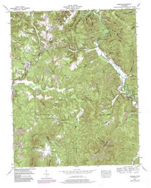
Robbins Topo Map Tennessee
To zoom in, hover over the map of Robbins
USGS Topo Quad 36084c5 - 1:24,000 scale
| Topo Map Name: | Robbins |
| USGS Topo Quad ID: | 36084c5 |
| Print Size: | ca. 21 1/4" wide x 27" high |
| Southeast Coordinates: | 36.25° N latitude / 84.5° W longitude |
| Map Center Coordinates: | 36.3125° N latitude / 84.5625° W longitude |
| U.S. State: | TN |
| Filename: | o36084c5.jpg |
| Download Map JPG Image: | Robbins topo map 1:24,000 scale |
| Map Type: | Topographic |
| Topo Series: | 7.5´ |
| Map Scale: | 1:24,000 |
| Source of Map Images: | United States Geological Survey (USGS) |
| Alternate Map Versions: |
Robbins TN 1952, updated 1953 Download PDF Buy paper map Robbins TN 1952, updated 1970 Download PDF Buy paper map Robbins TN 1952, updated 1980 Download PDF Buy paper map Robbins TN 2010 Download PDF Buy paper map Robbins TN 2013 Download PDF Buy paper map Robbins TN 2016 Download PDF Buy paper map |
1:24,000 Topo Quads surrounding Robbins
> Back to 36084a1 at 1:100,000 scale
> Back to 36084a1 at 1:250,000 scale
> Back to U.S. Topo Maps home
Robbins topo map: Gazetteer
Robbins: Bridges
Walker Bridge elevation 345m 1131′Robbins: Gaps
Chaney Gap elevation 503m 1650′Indian Grave Gap elevation 483m 1584′
Low Gap elevation 419m 1374′
Rock Lick Gap elevation 751m 2463′
Sophie Gap elevation 470m 1541′
Robbins: Mines
McCoy Big Mary Mine elevation 707m 2319′Poplar Creek Mine elevation 528m 1732′
Rainbow Mines elevation 442m 1450′
Robbins: Populated Places
Coal Hill elevation 453m 1486′Elgin elevation 427m 1400′
Glenmary elevation 389m 1276′
Hughett elevation 352m 1154′
Mill Creek elevation 460m 1509′
Robbins elevation 420m 1377′
Slick Rock elevation 369m 1210′
West Robbins elevation 440m 1443′
Robbins: Post Offices
Elgin Post Office elevation 427m 1400′Robbins Post Office elevation 421m 1381′
Robbins: Ridges
Big Pond Ridge elevation 476m 1561′Brimstone Ridge elevation 478m 1568′
Peter Cave Ridge elevation 474m 1555′
Schoolhouse Ridge elevation 530m 1738′
Robbins: Springs
Burnt House Spring elevation 462m 1515′Robbins: Streams
Aaron Branch elevation 341m 1118′Al Branch elevation 341m 1118′
Bagley Branch elevation 341m 1118′
Brimstone Creek elevation 333m 1092′
Buck Lick Branch elevation 394m 1292′
Butchers Creek elevation 389m 1276′
Cal Branch elevation 347m 1138′
Campground Branch elevation 396m 1299′
Copperas Branch elevation 390m 1279′
Cowan Creek elevation 401m 1315′
Gordon Branch elevation 359m 1177′
Hambright Branch elevation 429m 1407′
Huntsville Branch elevation 347m 1138′
Indian Fork elevation 347m 1138′
Long Branch elevation 363m 1190′
Macs Branch elevation 352m 1154′
Mill Creek elevation 401m 1315′
Miller Branch elevation 387m 1269′
Muley Branch elevation 378m 1240′
Pats Branch elevation 387m 1269′
Pemberton Branch elevation 342m 1122′
Webb Creek elevation 390m 1279′
Wells Branch elevation 365m 1197′
Robbins: Summits
Big Knob elevation 555m 1820′Coal Hill Mountain elevation 581m 1906′
Grassy Mountain elevation 733m 2404′
Griffith Knob elevation 512m 1679′
Little Mountain elevation 701m 2299′
Lowe Mountain elevation 598m 1961′
Sheep Rock Mountain elevation 563m 1847′
Robbins: Tunnels
Robbins Tunnel elevation 457m 1499′Robbins: Valleys
Bear Cove Hollow elevation 375m 1230′Boardtree Hollow elevation 352m 1154′
Brickyard Hollow elevation 375m 1230′
Cecil Hollow elevation 371m 1217′
Jeffers Hollow elevation 341m 1118′
Josh Hollow elevation 357m 1171′
Number One Hollow elevation 341m 1118′
Pond Hollow elevation 354m 1161′
Reed Hollow elevation 335m 1099′
Reuben Hollow elevation 348m 1141′
Rock Lick Hollow elevation 427m 1400′
Sawdust Hollow elevation 393m 1289′
Schoolhouse Hollow elevation 353m 1158′
Wallace Hollow elevation 343m 1125′
Robbins digital topo map on disk
Buy this Robbins topo map showing relief, roads, GPS coordinates and other geographical features, as a high-resolution digital map file on DVD:


