Appomattox Topo Map Virginia
To zoom in, hover over the map of Appomattox
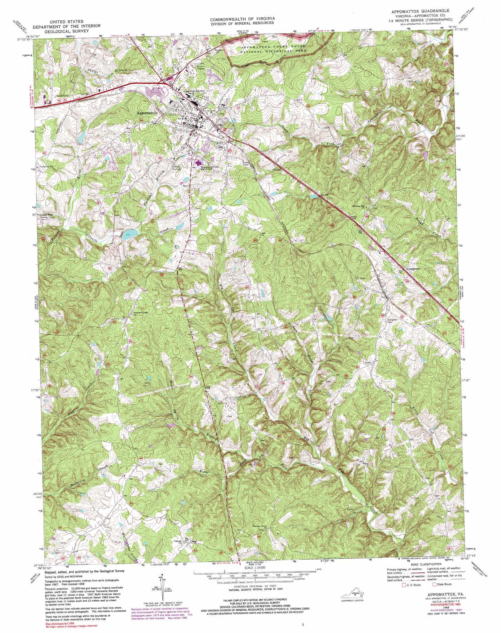
USGS Topo Quad 37078c7 - 1:24,000 scale
| Topo Map Name: | Appomattox |
| USGS Topo Quad ID: | 37078c7 |
| Print Size: | ca. 21 1/4" wide x 27" high |
| Southeast Coordinates: | 37.25° N latitude / 78.75° W longitude |
| Map Center Coordinates: | 37.3125° N latitude / 78.8125° W longitude |
| U.S. State: | VA |
| Filename: | o37078c7.jpg |
| Download Map JPG Image: | Appomattox topo map 1:24,000 scale |
| Map Type: | Topographic |
| Topo Series: | 7.5´ |
| Map Scale: | 1:24,000 |
| Source of Map Images: | United States Geological Survey (USGS) |
| Alternate Map Versions: |
Appomattox VA 1968, updated 1971 Download PDF Buy paper map Appomattox VA 1968, updated 1981 Download PDF Buy paper map Appomattox VA 1968, updated 1991 Download PDF Buy paper map Appomattox VA 2010 Download PDF Buy paper map Appomattox VA 2013 Download PDF Buy paper map Appomattox VA 2016 Download PDF Buy paper map |
1:24,000 Topo Quads surrounding Appomattox
Amherst |
Buffalo Ridge |
Gladstone |
Saint Joy |
Buckingham |
Kelly |
Stonewall |
Vera |
Holiday Lake |
Andersonville |
Rustburg |
Concord |
Appomattox |
Pamplin |
Prospect |
Gladys |
Mike |
Red House |
Madisonville |
Abilene |
Long Island |
Brookneal |
Aspen |
Charlotte Court House |
Eureka |
> Back to 37078a1 at 1:100,000 scale
> Back to 37078a1 at 1:250,000 scale
> Back to U.S. Topo Maps home
Appomattox topo map: Gazetteer
Appomattox: Airports
State Police Division Three Heliport elevation 254m 833′Appomattox: Dams
East Fork Falling River Number 15 Dam elevation 214m 702′East Fork Falling River Number 21 Dam elevation 221m 725′
Appomattox: Populated Places
Appomattox elevation 259m 849′Chap elevation 232m 761′
Evergreen elevation 222m 728′
Appomattox: Post Offices
Appomattox Post Office elevation 261m 856′Appomattox: Streams
Buck Branch elevation 152m 498′Caldwells Creek elevation 203m 666′
Left Hand Fork elevation 160m 524′
Maple Spring Branch elevation 172m 564′
Purdums Branch elevation 212m 695′
Right Hand Fork Big Cub Creek elevation 156m 511′
Appomattox digital topo map on disk
Buy this Appomattox topo map showing relief, roads, GPS coordinates and other geographical features, as a high-resolution digital map file on DVD:
Western Virginia & Southern West Virginia
Buy digital topo maps: Western Virginia & Southern West Virginia