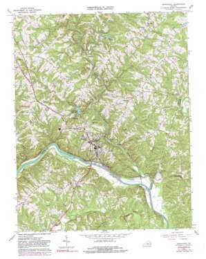
Brookneal Topo Map Virginia
To zoom in, hover over the map of Brookneal
USGS Topo Quad 37078a8 - 1:24,000 scale
| Topo Map Name: | Brookneal |
| USGS Topo Quad ID: | 37078a8 |
| Print Size: | ca. 21 1/4" wide x 27" high |
| Southeast Coordinates: | 37° N latitude / 78.875° W longitude |
| Map Center Coordinates: | 37.0625° N latitude / 78.9375° W longitude |
| U.S. State: | VA |
| Filename: | o37078a8.jpg |
| Download Map JPG Image: | Brookneal topo map 1:24,000 scale |
| Map Type: | Topographic |
| Topo Series: | 7.5´ |
| Map Scale: | 1:24,000 |
| Source of Map Images: | United States Geological Survey (USGS) |
| Alternate Map Versions: |
Brookneal VA 1966, updated 1968 Download PDF Buy paper map Brookneal VA 1966, updated 1981 Download PDF Buy paper map Brookneal VA 1966, updated 1990 Download PDF Buy paper map Brookneal VA 2010 Download PDF Buy paper map Brookneal VA 2013 Download PDF Buy paper map Brookneal VA 2016 Download PDF Buy paper map |
1:24,000 Topo Quads surrounding Brookneal
> Back to 37078a1 at 1:100,000 scale
> Back to 37078a1 at 1:250,000 scale
> Back to U.S. Topo Maps home
Brookneal topo map: Gazetteer
Brookneal: Dams
Bates Dam elevation 114m 374′Brookneal Dam elevation 128m 419′
Camp Hat Creek Dam elevation 145m 475′
Brookneal: Parks
Patrick Henry National Memorial elevation 157m 515′Brookneal: Populated Places
Brookneal elevation 163m 534′Hat Creek elevation 197m 646′
Holts Crossing elevation 180m 590′
Martins Store elevation 159m 521′
North Halifax elevation 177m 580′
Patrick Henry elevation 132m 433′
Perth elevation 184m 603′
Sugar Hill elevation 189m 620′
Terryville elevation 144m 472′
Brookneal: Reservoirs
Brookneal Reservoir elevation 128m 419′Camp Hat Creek Lake elevation 145m 475′
Brookneal: Streams
Dog Creek elevation 111m 364′Falling River elevation 107m 351′
Hat Creek elevation 117m 383′
Hickory Creek elevation 125m 410′
Little Childrey Creek elevation 112m 367′
Little Falling River elevation 122m 400′
Long Branch elevation 109m 357′
Snake Creek elevation 122m 400′
Tanyard Branch elevation 110m 360′
Whipping Creek elevation 117m 383′
Brookneal digital topo map on disk
Buy this Brookneal topo map showing relief, roads, GPS coordinates and other geographical features, as a high-resolution digital map file on DVD:
Western Virginia & Southern West Virginia
Buy digital topo maps: Western Virginia & Southern West Virginia


