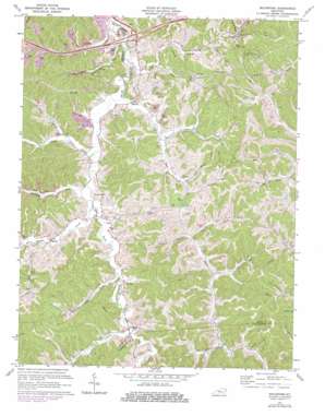
Boltsfork Topo Map Kentucky
To zoom in, hover over the map of Boltsfork
USGS Topo Quad 38082c6 - 1:24,000 scale
| Topo Map Name: | Boltsfork |
| USGS Topo Quad ID: | 38082c6 |
| Print Size: | ca. 21 1/4" wide x 27" high |
| Southeast Coordinates: | 38.25° N latitude / 82.625° W longitude |
| Map Center Coordinates: | 38.3125° N latitude / 82.6875° W longitude |
| U.S. State: | KY |
| Filename: | o38082c6.jpg |
| Download Map JPG Image: | Boltsfork topo map 1:24,000 scale |
| Map Type: | Topographic |
| Topo Series: | 7.5´ |
| Map Scale: | 1:24,000 |
| Source of Map Images: | United States Geological Survey (USGS) |
| Alternate Map Versions: |
Boltsfork KY 1953, updated 1955 Download PDF Buy paper map Boltsfork KY 1953, updated 1967 Download PDF Buy paper map Boltsfork KY 1971, updated 1972 Download PDF Buy paper map Boltsfork KY 1971, updated 1978 Download PDF Buy paper map Boltsfork KY 2010 Download PDF Buy paper map Boltsfork KY 2013 Download PDF Buy paper map Boltsfork KY 2016 Download PDF Buy paper map |
1:24,000 Topo Quads surrounding Boltsfork
> Back to 38082a1 at 1:100,000 scale
> Back to 38082a1 at 1:250,000 scale
> Back to U.S. Topo Maps home
Boltsfork topo map: Gazetteer
Boltsfork: Gaps
Davis Gap elevation 199m 652′Laurel Gap elevation 254m 833′
Boltsfork: Populated Places
Big Sandy elevation 186m 610′Boltsfork elevation 200m 656′
Cloverdale elevation 194m 636′
Garner elevation 195m 639′
Mavity elevation 187m 613′
Trace elevation 193m 633′
Boltsfork: Post Offices
Alley Post Office elevation 193m 633′Bolton Post Office elevation 198m 649′
Crick Post Office (historical) elevation 189m 620′
Culbertson Post Office (historical) elevation 191m 626′
Garner Post Office (historical) elevation 194m 636′
Grassland Post Office (historical) elevation 190m 623′
Grassland Post Office (historical) elevation 191m 626′
Logan Post Office (historical) elevation 198m 649′
Mavity Post Office (historical) elevation 189m 620′
Sayantum Post Office (historical) elevation 201m 659′
Boltsfork: Streams
Big Run elevation 183m 600′Bolts Fork elevation 199m 652′
Brooks Creek elevation 189m 620′
Clays Jack Fork elevation 193m 633′
Davis Creek elevation 190m 623′
Dog Fork elevation 188m 616′
Ellington Bear Creek elevation 184m 603′
Ellington Run elevation 181m 593′
Fourmile Creek elevation 188m 616′
Friendship Creek elevation 190m 623′
Garner Creek elevation 189m 620′
Huff Branch elevation 192m 629′
Jack Fork elevation 195m 639′
Laurel Creek elevation 182m 597′
Left Fork Trace Creek elevation 192m 629′
Long Branch elevation 195m 639′
McIntier Branch elevation 168m 551′
Music Branch elevation 181m 593′
Pigeon Roost Creek elevation 195m 639′
Right Fork Trace Creek elevation 191m 626′
Trace Creek elevation 187m 613′
Boltsfork digital topo map on disk
Buy this Boltsfork topo map showing relief, roads, GPS coordinates and other geographical features, as a high-resolution digital map file on DVD:
Western Virginia & Southern West Virginia
Buy digital topo maps: Western Virginia & Southern West Virginia


