Atwater Topo Map Ohio
To zoom in, hover over the map of Atwater
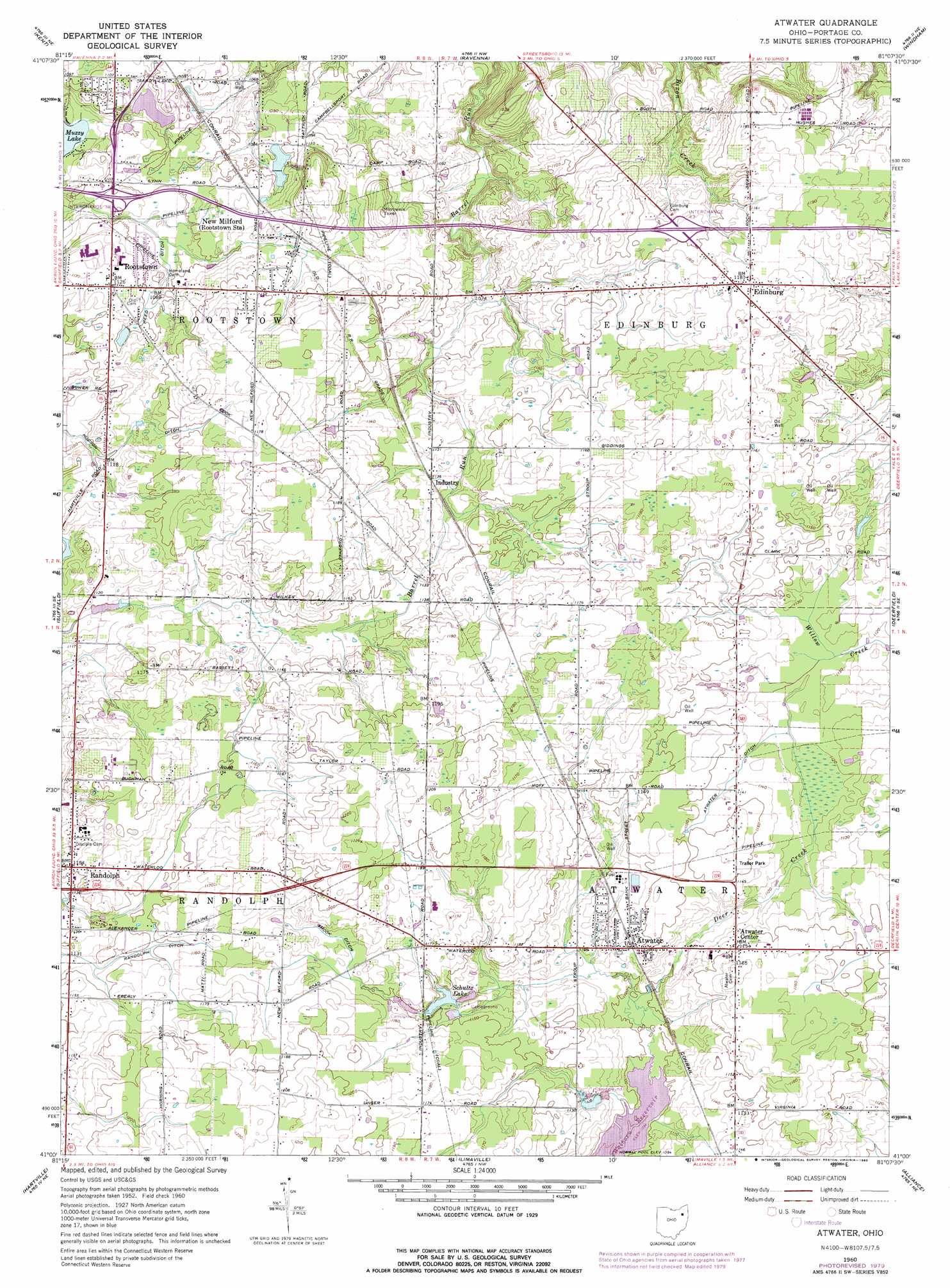
USGS Topo Quad 41081a2 - 1:24,000 scale
| Topo Map Name: | Atwater |
| USGS Topo Quad ID: | 41081a2 |
| Print Size: | ca. 21 1/4" wide x 27" high |
| Southeast Coordinates: | 41° N latitude / 81.125° W longitude |
| Map Center Coordinates: | 41.0625° N latitude / 81.1875° W longitude |
| U.S. State: | OH |
| Filename: | o41081a2.jpg |
| Download Map JPG Image: | Atwater topo map 1:24,000 scale |
| Map Type: | Topographic |
| Topo Series: | 7.5´ |
| Map Scale: | 1:24,000 |
| Source of Map Images: | United States Geological Survey (USGS) |
| Alternate Map Versions: |
Atwater OH 1960, updated 1961 Download PDF Buy paper map Atwater OH 1960, updated 1971 Download PDF Buy paper map Atwater OH 1960, updated 1980 Download PDF Buy paper map Atwater OH 1994, updated 1997 Download PDF Buy paper map Atwater OH 2010 Download PDF Buy paper map Atwater OH 2013 Download PDF Buy paper map Atwater OH 2016 Download PDF Buy paper map |
1:24,000 Topo Quads surrounding Atwater
Twinsburg |
Aurora |
Mantua |
Garrettsville |
Southington |
Hudson |
Kent |
Ravenna |
Windham |
Newton Falls |
Akron East |
Suffield |
Atwater |
Deerfield |
Lake Milton |
North Canton |
Hartville |
Limaville |
Alliance |
Damascus |
Canton West |
Canton East |
Robertsville |
Homeworth |
Hanoverton |
> Back to 41081a1 at 1:100,000 scale
> Back to 41080a1 at 1:250,000 scale
> Back to U.S. Topo Maps home
Atwater topo map: Gazetteer
Atwater: Airports
Gay Airport elevation 367m 1204′L and M Mold Corporation Airport elevation 332m 1089′
Atwater: Canals
Atwater Ditch elevation 347m 1138′Randolph Ditch elevation 346m 1135′
Reed Ditch elevation 331m 1085′
Shook Ditch elevation 352m 1154′
Atwater: Crossings
Interchange 38 elevation 335m 1099′Interchange 43 elevation 349m 1145′
Atwater: Dams
Ohio Farmettes Lake Dam elevation 336m 1102′Schultz Lake Dam elevation 350m 1148′
Atwater: Populated Places
Atwater elevation 344m 1128′Atwater Center elevation 352m 1154′
Countrywide Estates elevation 350m 1148′
Edinburg elevation 360m 1181′
Five Corners elevation 356m 1167′
Industry elevation 344m 1128′
New Milford elevation 342m 1122′
Randolph elevation 351m 1151′
Rootstown elevation 342m 1122′
Valley Hills elevation 331m 1085′
Atwater: Post Offices
Atwater Post Office elevation 343m 1125′Edinburg Post Office (historical) elevation 360m 1181′
Industry Post Office (historical) elevation 344m 1128′
New Milford Post Office (historical) elevation 342m 1122′
Randolph Post Office elevation 352m 1154′
Rootstown Post Office elevation 342m 1122′
Atwater: Reservoirs
Ohio Farmettes Lake elevation 336m 1102′Schultz Lake elevation 350m 1148′
Atwater digital topo map on disk
Buy this Atwater topo map showing relief, roads, GPS coordinates and other geographical features, as a high-resolution digital map file on DVD:
 map DVD")