Savage Ridge Topo Map Idaho
To zoom in, hover over the map of Savage Ridge
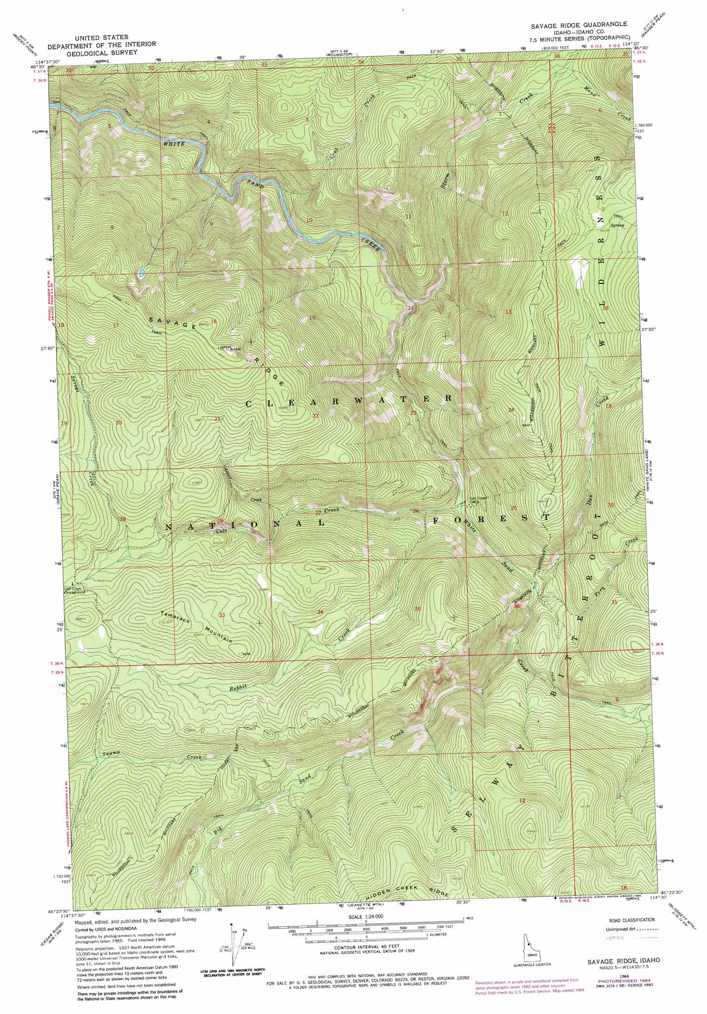
USGS Topo Quad 46114d5 - 1:24,000 scale
| Topo Map Name: | Savage Ridge |
| USGS Topo Quad ID: | 46114d5 |
| Print Size: | ca. 21 1/4" wide x 27" high |
| Southeast Coordinates: | 46.375° N latitude / 114.5° W longitude |
| Map Center Coordinates: | 46.4375° N latitude / 114.5625° W longitude |
| U.S. State: | ID |
| Filename: | o46114d5.jpg |
| Download Map JPG Image: | Savage Ridge topo map 1:24,000 scale |
| Map Type: | Topographic |
| Topo Series: | 7.5´ |
| Map Scale: | 1:24,000 |
| Source of Map Images: | United States Geological Survey (USGS) |
| Alternate Map Versions: |
Savage Ridge ID 1966, updated 1969 Download PDF Buy paper map Savage Ridge ID 1966, updated 1984 Download PDF Buy paper map Savage Ridge ID 1994, updated 1997 Download PDF Buy paper map Savage Ridge ID 2011 Download PDF Buy paper map Savage Ridge ID 2013 Download PDF Buy paper map |
| FStopo: | US Forest Service topo Savage Ridge is available: Download FStopo PDF Download FStopo TIF |
1:24,000 Topo Quads surrounding Savage Ridge
Rhodes Peak |
Granite Pass |
Lolo Hot Springs |
West Fork Butte |
Dick Creek |
Cayuse Junction |
Rocky Point |
Roundtop |
Ranger Peak |
Saint Joseph Peak |
Tom Beal Peak |
Grave Peak |
Savage Ridge |
White Sand Lake |
Gash Point |
Hungry Rock |
Cedar Ridge |
Jeanette Mountain |
Blodgett Mountain |
Printz Ridge |
Freeman Peak |
Wahoo Peak |
Saddle Mountain |
Tenmile Lake |
Ward Mountain |
> Back to 46114a1 at 1:100,000 scale
> Back to 46114a1 at 1:250,000 scale
> Back to U.S. Topo Maps home
Savage Ridge topo map: Gazetteer
Savage Ridge: Ridges
Savage Ridge elevation 2097m 6879′Savage Ridge: Streams
Alkire Creek elevation 1471m 4826′Big Sand Creek elevation 1355m 4445′
Colt Creek elevation 1300m 4265′
Crab Creek elevation 1188m 3897′
Dan Creek elevation 1323m 4340′
Fern Creek elevation 1324m 4343′
Maud Creek elevation 1370m 4494′
Rabbit Creek elevation 1328m 4356′
Savage Creek elevation 1678m 5505′
Storm Creek elevation 1232m 4041′
Swamp Creek elevation 1525m 5003′
Savage Ridge: Summits
Tamarack Mountain elevation 1869m 6131′Savage Ridge digital topo map on disk
Buy this Savage Ridge topo map showing relief, roads, GPS coordinates and other geographical features, as a high-resolution digital map file on DVD: