Herbine Topo Map Arkansas
To zoom in, hover over the map of Herbine
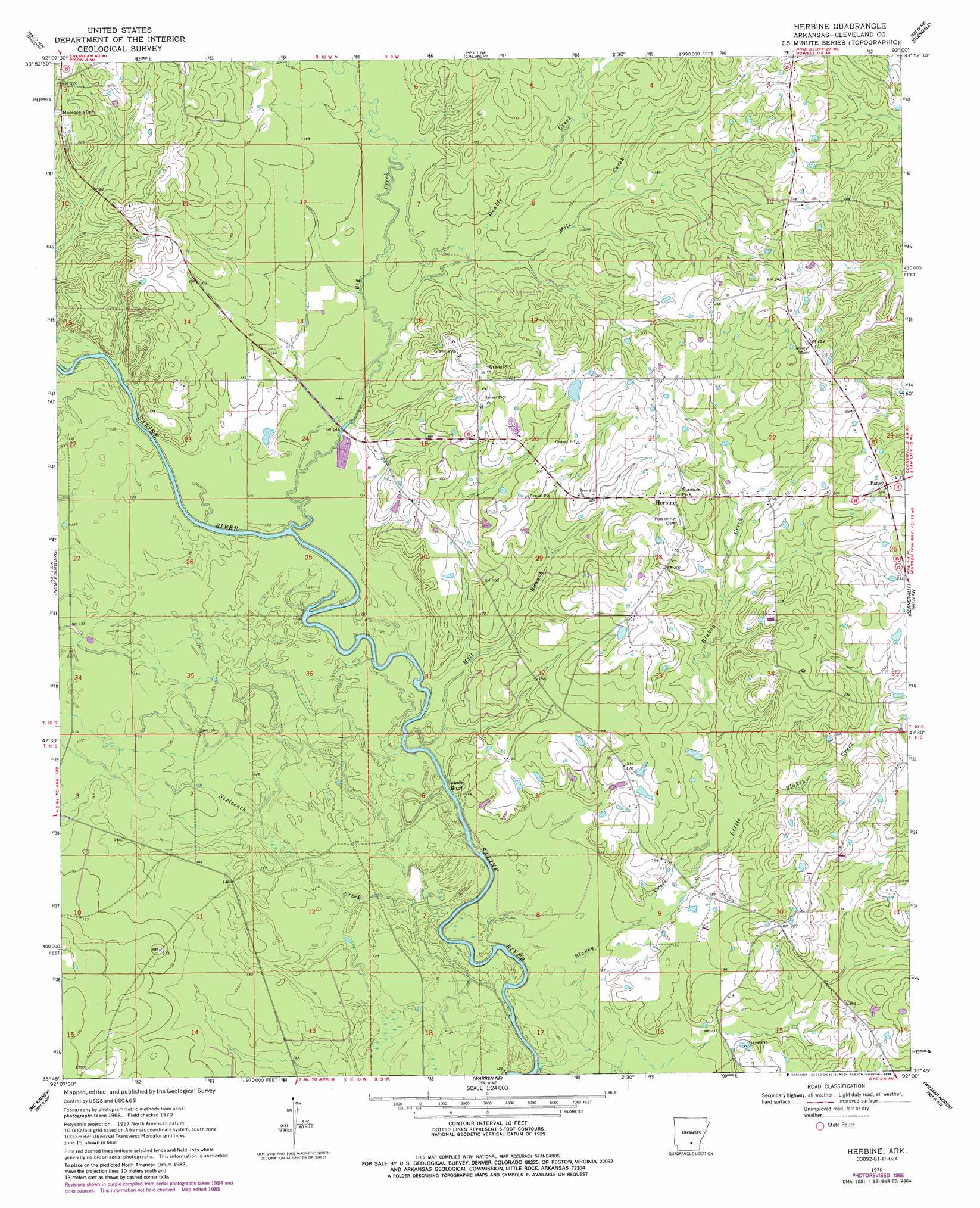
USGS Topo Quad 33092g1 - 1:24,000 scale
| Topo Map Name: | Herbine |
| USGS Topo Quad ID: | 33092g1 |
| Print Size: | ca. 21 1/4" wide x 27" high |
| Southeast Coordinates: | 33.75° N latitude / 92° W longitude |
| Map Center Coordinates: | 33.8125° N latitude / 92.0625° W longitude |
| U.S. State: | AR |
| Filename: | o33092g1.jpg |
| Download Map JPG Image: | Herbine topo map 1:24,000 scale |
| Map Type: | Topographic |
| Topo Series: | 7.5´ |
| Map Scale: | 1:24,000 |
| Source of Map Images: | United States Geological Survey (USGS) |
| Alternate Map Versions: |
Herbine AR 1970, updated 1972 Download PDF Buy paper map Herbine AR 1970, updated 1986 Download PDF Buy paper map Herbine AR 2011 Download PDF Buy paper map Herbine AR 2014 Download PDF Buy paper map |
1:24,000 Topo Quads surrounding Herbine
Staves |
Kedron |
Faith |
Pinebergen |
Tarry |
Fordyce Ne |
Rison |
Calmer |
Glendale |
Star City |
Kingsland |
New Edinburg |
Herbine |
Cornerville |
Relfs Bluff |
Tinsman |
Mckinney |
Warren Ne |
Wilmar North |
Monticello North |
Banks |
Farmville |
Warren |
Wilmar South |
Monticello South |
> Back to 33092e1 at 1:100,000 scale
> Back to 33092a1 at 1:250,000 scale
> Back to U.S. Topo Maps home
Herbine topo map: Gazetteer
Herbine: Cliffs
Vince Bluff elevation 39m 127′Herbine: Dams
Schultz Lake Dam elevation 65m 213′Herbine: Populated Places
Herbine elevation 73m 239′McKinney (historical) elevation 40m 131′
Pansy elevation 75m 246′
Ripley (historical) elevation 44m 144′
Herbine: Reservoirs
Schultz Lake elevation 65m 213′Herbine: Streams
Big Creek elevation 39m 127′Blakey Creek elevation 32m 104′
Bridge Creek elevation 37m 121′
Double Creek elevation 46m 150′
Little Blakey Creek elevation 39m 127′
Mile Creek elevation 46m 150′
Mill Branch elevation 37m 121′
Sixteenth Creek elevation 33m 108′
Herbine digital topo map on disk
Buy this Herbine topo map showing relief, roads, GPS coordinates and other geographical features, as a high-resolution digital map file on DVD: