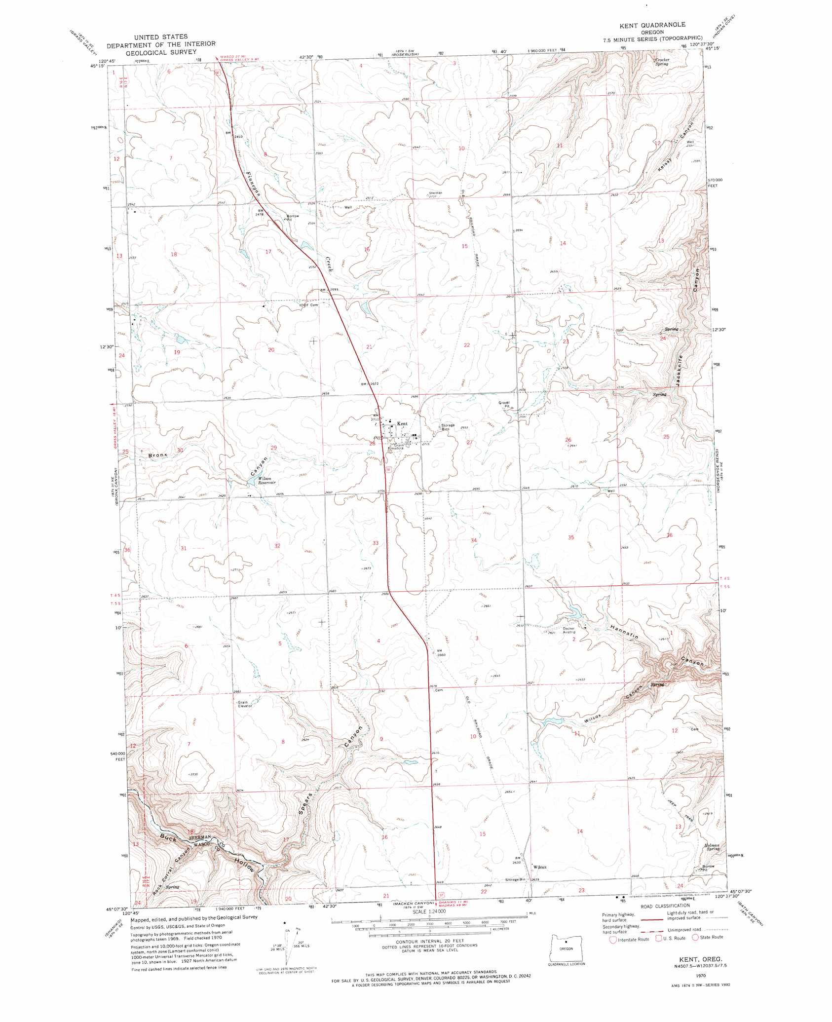
Kent Topo Map Oregon
To zoom in, hover over the map of Kent
USGS Topo Quad 45120b6 - 1:24,000 scale
| Topo Map Name: | Kent |
| USGS Topo Quad ID: | 45120b6 |
| Print Size: | ca. 21 1/4" wide x 27" high |
| Southeast Coordinates: | 45.125° N latitude / 120.625° W longitude |
| Map Center Coordinates: | 45.1875° N latitude / 120.6875° W longitude |
| U.S. State: | OR |
| Filename: | o45120b6.jpg |
| Download Map JPG Image: | Kent topo map 1:24,000 scale |
| Map Type: | Topographic |
| Topo Series: | 7.5´ |
| Map Scale: | 1:24,000 |
| Source of Map Images: | United States Geological Survey (USGS) |
| Alternate Map Versions: |
Kent OR 1970, updated 1973 Download PDF Buy paper map Kent OR 2011 Download PDF Buy paper map Kent OR 2014 Download PDF Buy paper map |
1:24,000 Topo Quads surrounding Kent
Summit Ridge |
Erskine |
Moro |
Harmony |
Esau Canyon |
Sinamox |
Grass Valley |
Rosebush |
Indian Cove |
Indian Spring |
Dead Dog Canyon |
Bronx Canyon |
Kent |
Horseshoe Bend |
Shoestring Ridge |
Criterion |
Shaniko |
Macken Canyon |
Bath Canyon |
Chimney Springs |
Shaniko Junction |
Shaniko Summit |
Antelope |
Hastings Peak |
Clarno |
> Back to 45120a1 at 1:100,000 scale
> Back to 45120a1 at 1:250,000 scale
> Back to U.S. Topo Maps home
Kent topo map: Gazetteer
Kent: Airports
Decker Ranch Airstrip elevation 805m 2641′Kent: Dams
Wilson Dam elevation 794m 2604′Kent: Populated Places
Kent elevation 827m 2713′Kent: Post Offices
Kent Post Office elevation 827m 2713′Kent: Reservoirs
Borstel Pond elevation 766m 2513′Wilson Reservoir elevation 794m 2604′
Wilson Reservoir Number Two elevation 791m 2595′
Kent: Springs
Crocker Spring elevation 737m 2417′Holman Spring elevation 763m 2503′
Kent: Valleys
Rock Corral Canyon elevation 680m 2230′Spears Canyon elevation 682m 2237′
Wilcox Canyon elevation 690m 2263′
Kent digital topo map on disk
Buy this Kent topo map showing relief, roads, GPS coordinates and other geographical features, as a high-resolution digital map file on DVD: