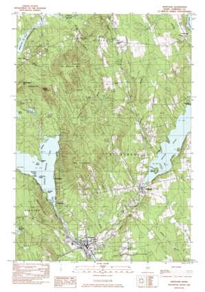
Hartland Topo Map Maine
To zoom in, hover over the map of Hartland
USGS Topo Quad 44069h4 - 1:24,000 scale
| Topo Map Name: | Hartland |
| USGS Topo Quad ID: | 44069h4 |
| Print Size: | ca. 21 1/4" wide x 27" high |
| Southeast Coordinates: | 44.875° N latitude / 69.375° W longitude |
| Map Center Coordinates: | 44.9375° N latitude / 69.4375° W longitude |
| U.S. State: | ME |
| Filename: | o44069h4.jpg |
| Download Map JPG Image: | Hartland topo map 1:24,000 scale |
| Map Type: | Topographic |
| Topo Series: | 7.5´ |
| Map Scale: | 1:24,000 |
| Source of Map Images: | United States Geological Survey (USGS) |
| Alternate Map Versions: |
Pittsfield NW ME 1975, updated 1980 Download PDF Buy paper map Hartland ME 1982, updated 1983 Download PDF Buy paper map Hartland ME 2011 Download PDF Buy paper map Hartland ME 2014 Download PDF Buy paper map |
1:24,000 Topo Quads surrounding Hartland
> Back to 44069e1 at 1:100,000 scale
> Back to 44068a1 at 1:250,000 scale
> Back to U.S. Topo Maps home
Hartland topo map: Gazetteer
Hartland: Bays
Northeast Cove elevation 74m 242′Hartland: Capes
Latty Point elevation 74m 242′Packard Point elevation 74m 242′
Sandbar Point elevation 75m 246′
Hartland: Dams
Great Moose Lake Dam elevation 68m 223′Lower Dam elevation 80m 262′
Lower Dam elevation 74m 242′
Upper Dam elevation 83m 272′
Hartland: Islands
Birch Island elevation 89m 291′Three Pine Island elevation 74m 242′
Torry Island elevation 74m 242′
Two Pine Island elevation 74m 242′
Hartland: Lakes
Great Moose Lake elevation 74m 242′Mainstream Pond elevation 92m 301′
Hartland: Pillars
The Pinnacles elevation 290m 951′Hartland: Populated Places
Cyrs elevation 93m 305′Hartland elevation 76m 249′
Saint Albans elevation 83m 272′
Stronghold elevation 96m 314′
Todds Corner elevation 211m 692′
Wildwood elevation 116m 380′
Hartland: Reservoirs
Indian Pond elevation 83m 272′Indian Pond elevation 91m 298′
Indian Stream Reservoir elevation 80m 262′
Mill Pond elevation 74m 242′
Hartland: Streams
Dickey Brook elevation 94m 308′Goodwin Brook elevation 75m 246′
Lyshornes Brook elevation 93m 305′
Meloon Brook elevation 82m 269′
Pratt Brook elevation 67m 219′
Railbridge Brook elevation 93m 305′
Ray Brook elevation 67m 219′
Hartland: Summits
Devils Head elevation 265m 869′Mainstream Mountain elevation 233m 764′
Rowell Hill elevation 179m 587′
Saint Albans Mountain elevation 319m 1046′
Hartland digital topo map on disk
Buy this Hartland topo map showing relief, roads, GPS coordinates and other geographical features, as a high-resolution digital map file on DVD:
Maine, New Hampshire, Rhode Island & Eastern Massachusetts
Buy digital topo maps: Maine, New Hampshire, Rhode Island & Eastern Massachusetts


