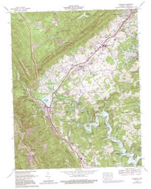
Jacksboro Topo Map Tennessee
To zoom in, hover over the map of Jacksboro
USGS Topo Quad 36084c2 - 1:24,000 scale
| Topo Map Name: | Jacksboro |
| USGS Topo Quad ID: | 36084c2 |
| Print Size: | ca. 21 1/4" wide x 27" high |
| Southeast Coordinates: | 36.25° N latitude / 84.125° W longitude |
| Map Center Coordinates: | 36.3125° N latitude / 84.1875° W longitude |
| U.S. State: | TN |
| Filename: | o36084c2.jpg |
| Download Map JPG Image: | Jacksboro topo map 1:24,000 scale |
| Map Type: | Topographic |
| Topo Series: | 7.5´ |
| Map Scale: | 1:24,000 |
| Source of Map Images: | United States Geological Survey (USGS) |
| Alternate Map Versions: |
Jacksboro TN 1936 Download PDF Buy paper map Jacksboro TN 1946, updated 1947 Download PDF Buy paper map Jacksboro TN 1952, updated 1954 Download PDF Buy paper map Jacksboro TN 1952, updated 1969 Download PDF Buy paper map Jacksboro TN 1973, updated 1975 Download PDF Buy paper map Jacksboro TN 1973, updated 1980 Download PDF Buy paper map Jacksboro TN 1973, updated 1991 Download PDF Buy paper map Jacksboro TN 2010 Download PDF Buy paper map Jacksboro TN 2013 Download PDF Buy paper map Jacksboro TN 2016 Download PDF Buy paper map |
1:24,000 Topo Quads surrounding Jacksboro
> Back to 36084a1 at 1:100,000 scale
> Back to 36084a1 at 1:250,000 scale
> Back to U.S. Topo Maps home
Jacksboro topo map: Gazetteer
Jacksboro: Airports
Campbell County Airport elevation 355m 1164′Jacksboro: Crossings
Interchange 134 elevation 323m 1059′Rocky Ford elevation 471m 1545′
Jacksboro: Dams
Caryville Dam elevation 311m 1020′Caryville Lake Dam elevation 311m 1020′
Eblen-Powell Number Two Dam elevation 417m 1368′
Jacksboro: Gaps
Bruce Gap elevation 415m 1361′Indian Gap elevation 380m 1246′
McGhee Gap elevation 885m 2903′
Rogers Gap elevation 577m 1893′
Jacksboro: Mines
Anthras Slope Mine elevation 659m 2162′High Point Mine elevation 732m 2401′
Sun Mines elevation 737m 2417′
Sun Pewee Mine elevation 910m 2985′
Jacksboro: Parks
Campbell County Park elevation 328m 1076′Cove Lake State elevation 324m 1062′
Jacksboro: Populated Places
Caryville elevation 333m 1092′Cove Creek elevation 391m 1282′
Cove Lake Estates elevation 382m 1253′
Cumberland View elevation 452m 1482′
De Lap elevation 340m 1115′
High Point elevation 334m 1095′
Highland Park elevation 375m 1230′
Hunter elevation 334m 1095′
Indian Creek elevation 403m 1322′
Jacksboro elevation 335m 1099′
Lindsay Mill elevation 334m 1095′
Oak Grove elevation 369m 1210′
Pine Crest elevation 398m 1305′
Red Ash elevation 350m 1148′
Ridgewood elevation 292m 958′
Silica elevation 349m 1145′
Vasper elevation 341m 1118′
Jacksboro: Reservoirs
Cove Lake elevation 311m 1020′Eagle Bluff Lake elevation 342m 1122′
Eblen-Powell Number Two Reservoir elevation 417m 1368′
La Follette Reservoir elevation 417m 1368′
Jacksboro: Ridges
Saltpeter Ridge elevation 408m 1338′Jacksboro: Springs
Cave Spring elevation 335m 1099′Eagle Bluff Springs elevation 351m 1151′
Johnson Spring elevation 334m 1095′
Lovely Spring elevation 337m 1105′
Shown Springs elevation 324m 1062′
Jacksboro: Streams
Adkins Branch elevation 323m 1059′Asher Branch elevation 339m 1112′
Bruce Creek elevation 311m 1020′
Brush Creek elevation 313m 1026′
Cuckle Creek elevation 311m 1020′
Dog Creek elevation 311m 1020′
Duncan Branch elevation 321m 1053′
Falls Creek elevation 315m 1033′
Hunter Branch elevation 311m 1020′
Johnson Branch elevation 311m 1020′
Laurel Branch elevation 433m 1420′
Left Fork Little Cove Creek elevation 341m 1118′
Little Cove Creek elevation 311m 1020′
Thompson Creek elevation 457m 1499′
Yellow Branch elevation 419m 1374′
Jacksboro: Summits
Eagle Bluff elevation 602m 1975′Fork Mountain elevation 674m 2211′
Jacksboro: Tunnels
Indian Grave Tunnel elevation 380m 1246′Jacksboro: Valleys
Bearwallow Hollow elevation 311m 1020′Brown Hollow elevation 311m 1020′
Disney Hollow elevation 347m 1138′
High Point Hollow elevation 341m 1118′
Mattie Randolph Hollow elevation 311m 1020′
Powell Valley elevation 318m 1043′
Queener Hollow elevation 311m 1020′
Shown Hollow elevation 311m 1020′
Spicewood Hollow elevation 311m 1020′
Stokes Hollow elevation 311m 1020′
Tidwell Hollow elevation 311m 1020′
Tunnel Hollow elevation 342m 1122′
Vasper Hollow elevation 342m 1122′
Jacksboro: Woods
Flat Woods elevation 538m 1765′Jacksboro digital topo map on disk
Buy this Jacksboro topo map showing relief, roads, GPS coordinates and other geographical features, as a high-resolution digital map file on DVD:


